Wednesday, July 13, 2016

Out of the Wyoming Basins

Day 36 - July 12th
36.2 miles
Total: 1422.9 miles
Moving Avg: 10.8 mph
Overall Avg: 8.1 mph

Every good zero must come to end. After a semi rough night of sleep (naps ruin night time sleep) we rose and slowly packed our gear up. We enjoyed coffee, yogurt, and oatmeal with our hosts before finalizing our packing and heading out of town.

As we made our climb out of Pinedale, it was a beautiful exploration of change in elevation. The wide valley we slowly climbed out of narrowed as the Bridger Wilderness with the Wind River Mountains creeped closer to the Gros Ventre Mountains. The flat farmland separated by willow covered agricultural drainage ditches gave way to gentle rolling hills of sage. Our road steadily climbed over the rolling hills, as more granite outcroppings pushed through the soil. Small granite boulders salted the landscape before the gap between the ranges narrowed to our minor pass for the day.

A gentle roll down the hill brought us to the Green River, where our paving ended, and a washboarded gravel road met us for the final miles. I was feeling tired from lack of sleep, and was happy to have a short day, as we rolled down into the pine and fir grove on the shore of the river.

Whiskey Grove Campground was greeted by the three of us with welcome arms, as we pitched our tents to take a small nap away from flies and mosquitos. Apricots and I awoke to the afternoon aroma of a campfire that Ville and made for the three of us to enjoy dinner beside. After dinner, we celebrated the end of the Wyoming Basins, the definitive passing of the halfway point, and the name of the campsite. We sat enjoying mini bottles of Whiskey at Whiskey Grove Campground, complements of Adrienne and Barbara. Their care package was well timed.

Tonight as we lay in the tent, we can here the rushing river, a sporadic raindrop, and hopefully no bears.

Live life at a slower place.

Sent From:
http://maps.google.com/maps?z=12&t=k&q=loc:43.25667+-110.02575

Monday, July 11, 2016

Zero in Pinedale

Day 35 - July 11th
4.8 miles
Total: 1386.7 miles

We opted for a rest day. And in the end, I am glad we did rest. The weather for today was much colder and more windy than it is to be tomorrow.

In the morning our gracious host provided coffee and donuts for breakfast. Then a warm shower. Then a day to rest, relax, and plan for our next leg. Apricots and I went to the Post Office first to pick up two care packages sent to us from friends (current and past coworkers). The boxes prepared had Emergen-C (much needed for electrolytes), nuts (much needed to spruce up our bland oatmeals), jerky (much needed protein to help repair our worked muscles) and a few extra fun treats.

We even received coloring crayons and paper cutouts of mosquitos, to help us build rapport with the blasted beast before us. Finally, there was some mini whiskey bottles, arriving just on time for tomorrow's intended campsite at Whiskey Grove Campground on the green river. If we don't camp there, we will camp at mosquito lake where the paper cutouts will help teach all type three vampires that we are friendly and need not be bitten.

(Thank you Cassie, Adrienne, and Barbara for your awesome care packages.)

After care packages, we hit the store to round out the food for the next leg, then to the library for Internet business, then to Pizza and Ice Cream for caloric restorative properties, then to host for R&R.

It was a good relaxing day.

Live life at a slower place.

Sent From:
http://maps.google.com/maps?z=12&t=k&q=loc:42.85846+-109.86431

Sunday, July 10, 2016

Short ride to Pinedale

Day 34 - July 10th
18.3 miles
Total: 1381.9 miles
Moving Avg: 10.7 mph
Overall Avg: 3.7 mph

This morning we treated Ville (not Phil) to breakfast. The day we met him at Diagnus Well was his birthday. He only remembered this fact the following day. It was our birthday gift to him, a hearty meal before a not-so-difficult 12 mile ride to Pinedale, Wyoming.

Even though our ride was along the highway between Boulder and Pinedale, it was not lacking in views. The road lay between the calm rolling hills of sage and grassland familiar to us from the basin, and the creeping foothills of the Bridger Wilderness. To our right lay pointed mountains carving at the sky with their sharp sawtooth peaks, gray and barren of trees. The peaks felt more like the Rocky Mountains I expected to see, than the Rocky Mountains I have seen. A few dark creases were highlighted with unmelted snow, hints of the strong winter which hasn't fully disappeared, despite the wind and heat that we are familiar with.

We sailed along the highway toward Pinedale, stopping only once at a roadside food cart serving burgers and ice cream. I am a sucker for ice cream, and Ville had already pulled in for a sweet treat. While we sat there enjoying our homemade ice cream on the side of the road, we watched a small Conestoga Wagon roll past, drawn by two horses. It was as if the history of the area we were passing through came to life. In reality, Pinedale was having its annual Rendezvous, a rodeo type celebration commemorating the days when the Mountain Ranchers would descend from the mountains to trade, drink, share stories, and hit on women.

Ville had arranged to stay with a WarmShowers host tonight. After taking a look at the camping accomodations, Apricots and I decided to go with Ville to his host and see if there was additional tent space. The hosts were extremely accomodating, inviting us in before we had time to ask.

The host showed us around the house. We have our own spare room in the garage with beds for the three of us. Then we went to the Laundromat and did laundry. The place was an exciting building full of hunting trophies mounted on the wall. See the attached pictures.

After laundry, we had lunch and returned to the hosts home for afternoon relaxation before dinner. Jay and Samantha, our kind hosts are out of town, so instead of Jay managing us, his mother and father are watching over the house and spoiling the grandchildren for their birthdays. As such, we had the joy of eating the dinner of choice for the birthday girl, a sphaghetti lasagna made with elk meat.

After dinner, we retired to the family room for evening social hour with sherbet  ice cream. Now bed time, with the pressing question... should we take a zero mile rest day tomorrow. Feel free to comment with your suggestions.

Live life at a slower place.

Sent From:
http://maps.google.com/maps?z=12&t=k&q=loc:42.85846+-109.86431

Saturday, July 9, 2016

Out of the Basin

Day 33 - July 9th
61.6 miles
Total: 1363.6 miles
Moving Avg: 8.9 mph
Overall Avg: 5.4 mph

We slept in.
It was glorious.

You would think that after the shorter day yesterday, we would be rested and rearing to go, but it seems that we wanted to rest. Besides, we had decided that 34 miles was all we were going to do today.

After breakfast, we packed up and had the late departure of 8:30. I was not in any rush, with an intended 34 miles, I wasn't looking to push hard. It was going to be our last day in the Great Basin, and I wanted to absorb some joy out of it. It's been beautiful, but hard.

Today had a perfect start. We rolled gently over hills of easy grade, slowly climbing to the continental divide (which we crossed twice). The hills were sprinkled with aromatic lavender. And our trail edged closer to the mountains of the Bridger Wilderness. Granite outcroppings sprinkled the hillside with the rotund boulders which felt out of place in the basin.

As the roller coaster terrain took us closer to the mountains, the presence of wind seemed to be non existent for us for the day. A gentle breeze felt periodically cooled our sun kissed skin. The best rest came from Little Sandy Creek, 22 miles into our day. I was a little low energy, and knew we had many hours to kill in our short day, so I convinced Apricots and Phil that it was time for a soak.

We laid our bikes down, kicked off our shoes and sat in the water. The initial shock was strong, but our bodies adjusted to the cool stream. We absorbed the relaxing flow for close to an hour before we rolling down the road. Twelve miles to camp.

When we arrived at our intended campsite (the spooky Buckskin Crossing of the Big Sandy River, with emigrant Graves nearby) we found the river was fenced off with No Tresspassing signs, and there wasn't a suitable place to tent. This was somewhat expected, as it was not marked as a campsite on the map.

So we went with our contingency plan. Push on to Boulder, Wyoming. Twenty-six gentle miles to a hot meal. While it was supposed to be gentle, it turned out to be harder than expected. The trail pushed up into the trees briefly, as if to hint of the mountains to come, before plunging back into the arid, shadeless basin we have grown strangely fond of. With that came the wind.

But, a burger awaited us in Boulder, so the three of us pushed hard against the wind for 26 miles (or 27 if you ask Apricots). Once here, I drank four large lemonades and two equally large glasses of ice water. We passed on the Rocky Mountain Oysters, and settled on tasty burgers.

A half mile full belly ride down the road to the RV park, and we got a flat tent site and a shower. Tomorrow we only need to bike 13 miles to Pinedale, where we intend to take a rest day.

Live life at a slower place.

Sent From:
http://maps.google.com/maps?z=12&t=k&q=loc:42.73856+-109.71445

Mine (town) Oming

Day 32 - July 8th
37.5 miles
Total: 1302 miles
Moving Avg: 6.8 mph

After yesterday's hard battle, we opted for a no alarm morning. We slept hard, and woke at 6:45. As we packed up, Phil woke up, and we ate breakfast together before making a dash for Atlantic City, 21 miles away.

The three of us rode at roughly the same pace, though it is apparent that Phil is a stronger cyclists. He has biked in Bolivia, Chile, and Peru (and probably some other places). The ride was a fairly standard fare great basin ride, through low laying shrub, and a sandy gravel road. The difference this day brought was that there was a mountain range in the distance to look upon.

And, just when I thought Wyoming had a ban on trees, I beheld a magnificent shade giving, wind blocking, shrubbery of such great girth it must be a tree. Sure enough, we had reached an elevation where trees could exist in nestled valleys of burger bearing buildings.

Yes, we arrived in Atlantic City, and the three of us plunged down a steep ravine straight into the only restaurant in town and ordered big juicy succulent burgers and soda. By meals end, we each had consumed four sodas with our big burgers, and we bought one for the road.

Since we have a care package to pick up in Pinedale, our pacing is being adjusted for a Sunday arrival, and a Monday pickup. This means we get to enjoy a couple low mileage days. As such, we only needed to knockout 15 miles after Atlantic City.

We rode out of the deep ravine of Atlantic City, back into the wind, and down into the next deep ravine of South Pass City. South Pass was a boom bust town of the gold mining era. It rose to a population of around 3000, and was the biggest city in Wyoming at the time. Now it has a population of four people and two dogs.

The state has worked to restore several buildings to their Gold Rush days, and now the town functions as a walking museum. We stopped in the general store, where all goods are packaged with their antique labels, and the shopkeeper is dressed in antique garb.

We bought a fat boy ice cream sandwich.

Then we pulled away from town, and cycled the remaining miles to camp, passing by historic landmarks on the Oregon Trail and Pony Express.

We are camped up river from a rest stop on the highway. It is out of the wind, there is a tree, and aside from the large volume of mosquitos, it is a rather pleasant site. All three of us even wandered over the Sweetwater River and took a pseudo swim, pseudo bath in the water. We even found some gold nuggets in the water, but we didn't want the extra weight, so we threw them back in.

Live life at a slower place.

Sent From:
http://maps.google.com/maps?z=12&t=k&q=loc:42.38395+-108.90501

Windy Whine Oming

Day 31 - July 7th
71.7 miles
Total: 1264.5 miles
Moving Avg: 7.3 mph

Here is a fun math problem. Assuming we averaged 9.9 miles per hour for the first 46 miles. What was our moving average for the remaining 25.7 miles if our moving average was 7.3 over the whole day?

Crazy folk that we are, we opted for a 3:45 wake up. It was our goal to make it to Atlantic City, 92 miles away. We crawled out of our sleepy state, and geared up for the 0.3 mile ride to Love's Travel Stop, where we bought coffee, electrolytes, and treats for the big day ahead.

Then we set off down county road 23 into the Great wide open basin. It was still dark, so we traveled by headlamp. Fortunately, the road was fairly smooth and easy going. In fact, we cruised along at eleven plus miles per hour. It was a joy to have such rapid miles disappear behind us. With that joy, we were able to see the Great Basin for its beauty. The gentle rolling hills covered in very low laying shrubs allow for expansive views. Nearly every view includes a Pronghorn (not to be confused with antelope), racing at speeds of up to 30-40mph after being frightened by our rolling tires, sometimes even bursting to 60mph. I wonder how their ankles handle the irregular terrain.

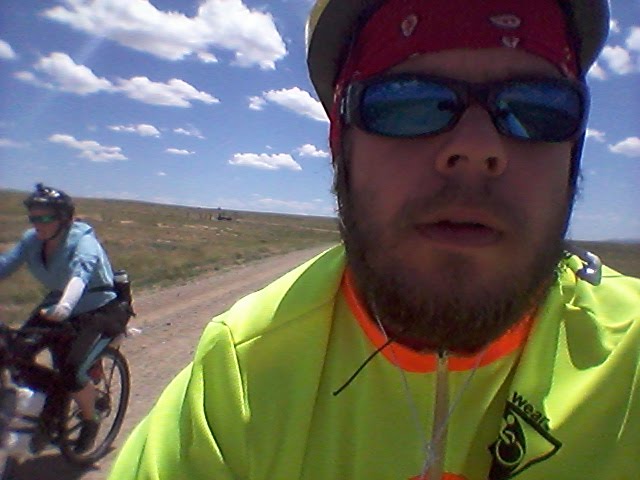
As the miles slid past, we encountered a number of tail end racers, and a couple tour cyclists. We exchanged tips on water and road conditions ahead, and continued on our way.

For me, the day was stressful. My GPS has the official Great Divide Route on it, and my phone has the official Tour Divide Route on it. We are in an area where the two paths deviate, and I lack a narrative description of the path we were taking. I was relying on Google maps for the narrative description. After 60 percent of the days ride was done, I discovered that the Google narrative no longer matched either route. We were essentially traveling without a map, as our map doesn't show the area we were traveling. This was very nerve racking to me... and perhaps a little foolish in the very open, very dry, very hot, and very solitary great basin.

Nevertheless, we trudged on. I had looked deeply at the Google Earth Images and saved what I could to my phone. I opted to continue with a shoddy map, because it was better than the alternative. Other cyclists described the official Tour Divide Route as having an eight mile stretch where the road disappears out of disuse.

We traveled down a lonely BLM road into the windy depths of the Basin. We were likely the only people in several hundred square miles, and the wind introduced itself as a 25 mph headwind. The road introduced itself as a ridge road. This meant that we were massively exposed. On the bright side, the route was stunning. We struggled against the wind, beating our willpower to a pulp, but the ripples of ridges reaching into the Basin in their multicolored tendrils of sand and stone replenished our energy.

It was an amazing dichotomy of struggle and inspiration. I felt beat down through the whole afternoon, every view forward was a straight long shot of the same boring windy struggle before us. On the other hand, all the views back were stunning shots of accomplishment and perseverance.

After an hour nap in the wind and sun, we made the final push of the afternoon. I wanted to make sure we made it back to the official route, as I wasn't completely sure where we would reconnect, so my knowledge of water sources before us were a little unclear. Sixteen miles later, we hit the official route, exactly where I expected and hoped.

One and a half miles later, we were at Diagnus Well. As we rolled in, exhausted from an uphill climb in the washboarded sand, against the wind, facing the sun, I startled another cyclist who was set up to camp at the well.

His first words were: "THAT WAS A ROUGH DAY, YES?"

I knew he was also a northbound cyclists, as he also rode into the wind.

Phil, from Finland, made for very enjoyable conversation while we made dinner. He is out for three months, and we have been tailing him by a half day for most of our ride. We sat in the shadow of our tent, watching the sun set on what the three of us agreed was the most difficult day of our tour this far, mostly because of the mental exhaustion.

We have about two more days before we get out of the windy basin.

Live life at a slower place.

Sent From:
http://maps.google.com/maps?z=12&t=k&q=loc:42.30928+-108.47741

Wednesday, July 6, 2016

Why? Oming

Day 30 - July 6th
61.4 miles
Total: 1192.8 miles
Moving Avg: 7.5 mph

The day started out with a solid climb out of a very beautiful river valley. As we gained elevation, we saw a dog eyeing us on the road. After about two miles of watching us, she came and introduced herself to us. No collar, save for some green spray paint on her neck, we didn't know where her home was. She definitely has a large roaming area.

She followed us for the next six to seven miles. She even chased two Pronghorn through the shrubbery for a very fast half mile run. Eventually she came back to us. We tried to get her to go home, but she kept following us into the Great Basin. Since we were gaining elevation, it was easy for her to keep up with us.

Once we hit the downhill she had to run to keep up. Then we passed a cattleguard. She struggled to get through it, and we made our distance. A mile further down the road I looked back, and in the distance I saw her running down the road after us. Fortunately we were too far and too fast, so we lost our tail. (Unfortunately too. She was super beautiful, very calm, and would have made for the most amazing "she followed me home" story)

A couple miles later, we ran into a rancher. He spoke no english, but that didn't stop him from telling us his life story. From what we understood, he moved from Steamboat to Wyoming as the prices were unreasonable in Steamboat. He has five kids, four in Mexico, and one in California. He was out repairing the fences of his ranch.

After that conversation, we made the final descent into the Great Basin, including a four mile stretch along a road that was perhaps the least roadlike experience we have had on the trail. Apricots kept teasing me every time I referred to the path as a road. Surely it was too beat up and overgrown to be considered a path for ATVs.

Then thirty miles of nothing but unbearably bumpy straight road of nothingness. With a solid side wind.

Thirty straight miles.

The view never changed.

Thirty straight miles.

The washboard gravel was consistently bumpy.

Thirty straight miles.

Every passing truck kicked sand in the air as we closed our eyes and held our breath for a second or two.

Thirty straight unchanging miles.

Nearing wamsutter the wind was stronger, and a light rain fell for a brief moment on us. We settled into the idea of getting a hotel for the night. Tomorrow we have 92 similar miles to Atlantic City. We are waking super early to try and beat the wind.

I don't know if we will make it all 92, but we are going to try. For kicks, you should take a look at the link below to see the vast barreness of the Great Basin that we are crossing.

Time to sleep. Super Early morning tomorrow.

Live life at a slower place.

Sent From:
http://maps.google.com/maps?z=12&t=k&q=loc:41.67236+-107.98012

Into Wyoming

Day 29 - July 5th
57.6 miles
Total: 1131.4 miles
Moving Avg: 8.1 mph
Overall Avg: 6.1 mph

The good thing about sleeping behind a country store is that you can wake up to some killer breakfast sandwiches and good coffee.

The breakfast powered us up the hill to Steamboat Lake. It was too early to bother thumbing a ride over the nine miles we had already covered. Besides, we opted to take the Columbine Alternate, so the nine miles to Steamboat Lake worked better by approaching the alternate from the other side of the lake.

At the lake we opted out of getting a snack at the local store, as we knew Columbine a few miles further along had cabins, and coffee, and donuts, and yummy pleasantries. So, we cycled the rest of the way to the pass to Columbine.

Sadly, the store in Columbine was closed as it was the Monday after a holiday. No worries, we were still fueled for the downhill ride. We rolled past Colbie into the freckled sunlight of a million Aspen. It was a beautiful stretch of countless Aspen Grove, and classic Colorado mountain roads.

As we lost elevation, we entered into Three Forks Ranch, an enormous complex of lodges, cabins, and fishing and hunting grounds. I don't think the ranch had any cattle or horse to speak of, but they did have a lawn so large that the grounds keeper probably is continually mowing it to even keep up with the growth from end to end. The Ranch is one of those billionaire vacation spots, where nightly costs for cabins can run around five thousand dollars.

Ten miles later we exited the ranch, and hit the highway a few miles after that. In the last stretch we wiggled between Colorado and Wyoming, crossing the border five times before settling into Wyoming.

In the very small town of Savery (population 24), we stopped in at the local museum and met Lela. We had prearranged with Lela to stay at her house seven miles north of Savery.

Two chocolate milks downed in Savery, and we were on the final stretch to her home. The house was beautiful inside and out. She puts the home up on Airbnb.com if you are interested in planning a trip down to the great basin.

Tomorrow we begin the long dry stretch across the Basin. Hopefully it will be beautiful.... and not too much of the same view for miles on end.

Live life at a slower place.

Sent From:
http://maps.google.com/maps?z=12&t=k&q=loc:41.10899+-107.36697

Tuesday, July 5, 2016

Happy 4th of July

Day 28 - July 4th
41.4 miles (plus 17 backtrack slacker miles)
Total: 1073.8 miles

I could get use to sleeping in. Since we were being visited by Loren and Natalie, we opted to have a leisurely morning. Around six am, the sun woke me. We packed slowly, and eventually I woke Loren and said it was time to rise and shine.

The four of us enjoyed hot coffee while Dexter sat idly by. What an awesome bulldog. Apricots and I said our goodbyes, and thanked Loren and Natalie for helping is out and visiting us. On our way away from camp we talked briefly with other tour cyclists. Then we began our 40 mile ride to Steamboat Springs.

The ride was a very gentle grade, and we enjoyed the very nice tread we rode along. Soon enough we arrived at The Elk Run trail, a simple single track trail which runs the perimeter of Stagecoach Reservoir. It was pretty fun hitting some simple trail riding, most everything we have seen this far has been roads (although some I wouldn't take a car on). This was a pedestrian trail with light gravel, and rolling hills.

We took lunch at the Dam, and then rolled the final 21 miles down to Steamboat Springs, mostly along the Yampa river. Once in town, we stopped at rhe grocery for relaxation and resupply, then we stopped at the bike shop for a quick inspection. Everything looked great.

On the far side of town we hit the road that we came down yesterday. We were not keen on cycling 26 miles uphill, especially since we cycled it yesterday. As such, we stuck out our thumbs on the semi quiet road.

An hour plus later, a car said they would run home and grab their bike rack and then drive us up the road to Clark. We waited about twenty minutes, and they returned with a bike rack. Dropped at the store, several miles shy of our intended goal, we weighed our options. With little daylight left, we settled for camping at the general store.

In the distance we can here the fireworks. But we should be able to find sleep quickly. We have to rise before the store opens, which is good, as we have a bigger day tomorrow.

Live life at a slower place.

Sent From:
http://maps.google.com/maps?z=12&t=k&q=loc:40.70681+-106.91931

Monday, July 4, 2016

Southbound for a day

Day 27- July 3rd
28 miles (plus 58 backtrack slacker miles)
Total: 1032.4 miles

We slept in this morning. It has been a much needed rest, and the way we felt after the ride showed us the importance of rest days.

Gina and Karen continued their great hospitality by making a delicious breakfast, ensuring we had adequate water, and stockpiling a bag of treats from the sugar tray. We waited long enough for our tent to dry from the rain before setting out. We said our goodbyes and thank yous to Audrey for snagging us, and the hosts for everything else, and then set out on our way.

Our plan: cycle southbound to Steamboat Springs, meet up with an old friend who could shuttle us back to where Audrey picked us up, camp, and then cycle northbound to Steamboat Springs.

And that is what went down. We set off from our hosts, and cycled nine miles to Clark, and checked out a really cute county store / library / post office / ice cream parlour. From there. We cycled the nineteen miles to Steamboat Springs through vast ranchland and cool river valleys with freckled sunlight, where motorists share the road with cyclists.

The clouds had finally parted, just in time for the holiday festivities. Many locals (and likely tourists), were calmly drifting down the Yampa river on various flotation devices. Apricots and I made record pace into town. We then sat at a barbecue joint, waiting for Loren and Natalie to make their way into town.

I met Loren when I hiked the Pacific Crest Trail in 2005. My first hike, which covered about 1100 mikes, ended shortly after spending several days hiking with Loren and Denise (aka "Boone" and "Sas"). Eleven years later, Loren contacted me to make sure he could come trail Angel me and Apricots on our Great Divide tour.

Today, he helped out greatly. Natalie (his wife of three weeks) and Dexter, their bulldog, provided great company for our pseudo vacation from vacation. They were happy to get out of town to, as all of their pre and post wedding activities had actually prevented them from getting out for a break of their own.

They shuttled us up to Lynx Pass campground, close to where we jumped on board with Audrey. We enjoyed some wine, some games, and a campfire as the sun set. Strange enough, sometimes our cycling adventure exhausts us too much to actually sit back and enjoy the space we are in.

We consumed the wind, the trees, the stars, the clouds, the smell of campfire, and the good company to heal our energy and spirits. Tomorrow, we will sleep in and say goodbye before returning to Steamboat Springs via the official trail.

It was a lovely day. A true Colorado experience.

Live life at a slower place.

Sent From:
http://maps.google.com/maps?z=12&t=k&q=loc:40.10552+-106.68197

Sunday, July 3, 2016

Highway to Heaven

Day 26 - July 2nd
4.6 miles
Total: 1004.4 miles
(Plus 69.6 slacker miles, but we are gonna backtrack)

I woke at sunrise. The rain had stopped. It had rained all night. I had high hopes that the clouds had dumped all their water, and the day would be rain free. I gently woke Apricots, and said it was time to go. We had a choice between 16 miles of highway and forty trail miles, or 48 highway miles.

Well the shorter distance trumped the official route. We packed up, and just before we crawled out of the tent, the rain started falling. Big sigh. It was not going to be a good day. Fortunately, it was a light sprinkle, and we wanted to put as many highway miles behind us as we could before the Fourth of Julyers took over the road.

The first mile was nice with a decent shoulder. But that changed, and traffic was unusually high for six am. Four and a half miles behind us, Apricots had started inventing new swear words, and the mosquitos were already out in double droves.

We pulled to the side of the road at a turnout area. We discussed our options. Should we backtrack and take the official route? Should we hitchhike? Should we violently throw our bikes in front of a passing semi? Should we throw ourselves in front of a semi?

One thing is for certain, we wanted coffee. Apricots pulled out the bowls while I half heartedly stuck my thumb out at passing trucks. Suddenly a minivan pulled over and asked if we needed anything. I defeatedly said no. Then the driver asked if we would like a ride. Shocked at the idea that it would work, we excitedly said yes, if our gear could fit in the van.

Ten minutes later all our gear was crammed into a minivan, and we were making record pace to Steamboat Springs. Our trail angel, Audrey, was super stoked to have picked up two great divide tour cyclists. She plans on doing a 28 day south bound ride starting early August. Giddy for the potential knowledge swap, and caring for the pathetic state we appeared to be in, she invited us to her friends house.

Her friends were having a fourth of July party up at Steamboat Lake, with about fiteen other adults. The cabin in the mountains looked out on the lake, where an early firework show would be put on.

While we stopped for a fresh batch of hot coffee in town, Audrey cleared it with her friends. Then Audrey treated us to breakfast, insisting we eat as much as we could. I consumed biscuits and gravy and bacon and creamcheese french toast. Heavenly.

Post breakfast, we headed up to Gina and Karen's house at Steamboat Lake. We were greeted with warm welcomes, offers for showers and Laundry Service, and promises of amazing afternoon barbecue delights.

We socialized throughout the afternoon, and took a nap. My health neared full finally after I got a full day of rest. We consumed amazing barbecue delights and sweet treats, and b socialized into the evening.

Then an amazing storm swept into the valley. The wind whipped up to violent speeds, and rain pounded so heavily on the house, the roof appeared to spring a couple leaks. Lightening was striking less than a second away. We all jumped inside, wondering whether the weather would wipe the evenings firework show.

Thirty minutes later the storm had passed the house. In the distance we could still see solid lightening bolts striking the mountains. The pyrotechnicians jumped on the open weather window, and let the a how start. We watched explosions in the sky, multicolored blasts back dropped by the nature's own firework show.

Two simultaneous shows for our delight, in the company of good people.

Shortly afterward, we made our way to the tent. Everything inside remained dry through the storm, and we had solid rest awaiting us, after our much needed rest day.

Live life at a slower place.

Sent From:
http://maps.google.com/maps?z=12&t=k&q=loc:40.79350+-106.99451

Saturday, July 2, 2016

Highway to Hell

Day 25 - July 1st
45.8 miles
Total: 999.8 miles
Moving Avg: 9.4 mph
Overall Avg: 5.7 mph

On the bright side, it didn't rain on us.

The official route travels twelve miles down highway nine, before cutting off to the mountains and returning to highway nine again thirty eight miles later.

The weather predicted rain, and the health wasn't 100 percent, so we opted to follow the highway all the way. It would shave off about ten miles. If you haven't guessed by now, I am more than a sliver removed from a purist. I am out to bike from Mexico to Canada, mostly on the Great Divide route. Key word: mostly. I am happy to find shortcuts/easier routes.

We thought we had picked one in the highway. It would be largely downhill and paved.

Woopse, turns out that they were doing some major highway construction. After the initial twelve mile downhill section, the shoulder disappeared. We had to cycle next to crazy fourth of July travelers. Past the point of no shoulder, the paving disappeared. We had to cycle on loose mud, from fresh rain, or on the main path of travel for cars....and there were plenty of cars.

We weaved between orange traffic cones, mud which had more control over our bikes than we do, and fast moving RVs hauling cars. It was a unique cycling experience, one which I hope to never repeat. The highway reconstruction zone lasted about six miles, and we were happy to find paving at the end of it.

Nine miles later, we arrived in Kremmling, where we found an ice cream and coffee shop. How neat is that!? We enjoyed cold sweet caffeinated beverages, and planned our next course of action. The addendum to the maps discussed a portion of the trail which is impassable when wet. This is the portion we were about to embark on. Since it rained the last two days, and rain was anticipated for the next two, we were not keen on taking the official route.

The highway had an alternate which routes us past the impassable part, so we settled for more highway riding. I found a campsite six miles past Kremmling, and we were fortunate to get a reservation. I still marvel that places (with no services other than pit toilets) can charge $25 for a tent space. But, it is what it is, and it is fourth of July weekend.

We bought groceries for the short leg, and went on our way to the site. I didn't think our highway experience could get worse, but it did. Our six inches of no shoulder space turned into zero inches of no shoulder space. Our gravel shoulder turned into a grassy shoulder. Our flat shoulder turned into a bumpy steep shoulder which forced us to walk our bikes. Our weekend travelers doubled in frequency. And finally, the mosquitos decided to attack us in droves.

I haven't seen Apricots swear this much in any leg of the trail. I am truly shocked that I didn't see her throw the bike at an oncoming car and call it quits as she watched the bike explode into millions of pieces. She told me that she has no idea if the area we passed through was beautiful, because she was too busy being stressed at holiday weekend traffic. The six miles out of Kremmling have easily been the worst highway miles we have traveled.

But in the end, we arrived at camp, and set up our tent. Fifteen minutes later the rain came, and it hasn't let up for the last two hours. I am so glad we didn't have to bike in the rain.

Now.... can I get to sleep to the rhythmic beats of our neighboring RVs music?

Earplugs, here I come.

Live life at a slower place.

Sent From:
http://maps.google.com/maps?z=12&t=k&q=loc:40.14413+-106.41468