Saturday, July 31, 2010

Sobo to Crater Lake

Day 109-July 31st
Destination: Crater Lake Rim
Miles: 12 (plus 1 off trail mile)
Cumulative Miles: 1516.5

We woke this morning after getting some of the best rest we've had in more than a week. Fully rested, we went to a breakfast buffet with Apricots' mother, before saying goodbye to her. Today she is driving south to visit Apricots' brother. As her car was full, we had to try to hitch back to the trail.

We decided to hike from Diamond Lake, southbound (Sobo) back to Highway 62 where we left yesterday. This would make for an easier hitch, and more time for our resupply package to arrive at Crater Lake. Once we get back to Highway 62 (tomorrow) we will check to see if our resupply has arrived, and then hitch to Diamond Lake and continue northbound (Nobo). Team Psychricots is a jumping flip-flopping team if nothing else.

Sitting on the side of the highway, we waited out the day in long slow hours, as most of the traffic was heading in the wrong direction. While waiting at the road, trying to hitch a ride back to the trail, a truck drove up. The passenger asked if we were hiking the PCT. We told her yes, and she said her father hiked the trail last year. She couldn't give us a ride, but she did give us a bag of M&M's and a large Gatorade. We saw them driving into Diamond Lake, which means they turned around to drive out and gift us. Once again, the kindness of strangers blesses us.

After close to three hours of hitching, we secured a ride that took us exactly to where we needed. Their timing was perfect, because we were beginning to question alternative options for getting back to the trail. Furthermore, they dropped us off with just enough time to hike up to the rim, and grab a camping spot with a perfect view of the lake as the sun set.

We made the 12 mile hike and sat on the rim, staring at the majestic blue water, as the sun cast it's last red hues on the opposite rim. The lake is more beautiful when you have to walk up to it, rather than just driving up to the viewpoint. We walked across pumice flats where light rocks of pumice lined our trail through the volcanic dust and gravel. The trees cleared just before reaching the rim, and we were given a fantastic view of "The Watchman", one of the rocky crags that sits on the rim.

Beautiful camp.


Hiking for Cherryville Heartsongs
Visit our blog to find out how to donate
http://northboundheartsong.blogspot.com

Sent via BlackBerry from T-Mobile

MD

Day 108-July 30th
Destination: Highway 62
Miles: 19.5 (plus 0.9 off trail miles)
Cumulative Miles: 1504.5

Today was a simple day. Our hike was less than 20 miles (more or less), and there were no significant grade changes. Most of the trail wandered through flat-ish forest, and most of the higher points were without noteworthy views. Yet the lack of views were not constant and certainly didn't detract from the day.

We had passed through a burn zone that was rich with new growth. The green grass complemented the reds and browns left behind in the blackened forest.

When we reached the highway, we walked about a mile down the highway to Mazama Village, the small campground/development at the bottom of Crater Lake. At the store, we found out our resupply package had not yet arrived. This required us to develop a creative strategy for the next leg.

As Apricots' mother is visiting us, and we are staying at Diamond Lake, we plan to hike south from Diamond Lake back to Mazama Village. This will allow a little more time for our resupply to arrive while allowing us to continue hiking.

On a side note:
We have now passed the 1500 mile mark. Woohoo!!

Hiking for Cherryville Heartsongs
Visit our blog to find out how to donate
http://northboundheartsong.blogspot.com

Sent via BlackBerry from T-Mobile

Thursday, July 29, 2010

Mosquito Mosquito, My Lustful Mosquito

Day 107-July 29th
Destination: Honeymoon Creek
Miles: 22 (plus 1.6 off trail miles)
Cumulative Miles: 1485

Most all of today was about mosquitoes. We wore our pants and long sleeves for the entire day, despite the heat. We also wore our mosquito head nets most of the day, which caught glare from the sun, making it difficult to see where to step occasionally. Overall though, despite the mosquitoes, today was a fairly nice day.

We walked 4.5 miles before having our morning coffee and breakfast. Huddled in our rain coats, to keep the bugs from biting, we quickly ate our oatmeal and trail mix. Afterwards, we hiked another 12 miles to snow lakes where we ate lunch. But just prior to lunch we faltered in our navigating.

Sometimes we find ourselves wishing the trail designers had put more thought into the way they designed trails. For example, placing a trail junction at a sharp turn in the trail is not a good idea. Both of us failed to see that the PCT cut sharply to the left, which resulted in both of us turning on to a side trail. We only realized this after walking over half a mile down the wrong trail, which meant we had to turn around and walk the half mile plus back up to the PCT.

Once rejoined with the PCT, we dropped off it for lunch at snow lakes. After lunch we hiked up past Lucifer rock and Devil's Point. Lucifer rock looked like a towering tidal wave of lichen covered rock towering overhead. We were filled with a little unease as we looked up at the looming crumbly rock which could collapse at any moment, but we passed it by with no harm and carried on to Devil's Point which was tamer by far.

Dropping down and hiking a few more miles we arrived at Honeymoon Creek. We set up camp here, and look forward to a shorter day tomorrow, into Crater Lake. The mosquitoes joined us for dinner. Now they are whining dramatically, angry at us for not letting them into our tent and killing those who snuck past our gate guards.


Hiking for a cause
Visit our blog to find out how to donate
http://northboundheartsong.blogspot.com

Sent via BlackBerry from T-Mobile

Wednesday, July 28, 2010

Lava Rocks

Day 106-July 28th
Destination: MM 1788ish
Miles: 25.5 (plus 0.2 off trail miles)
Cumulative Miles: 1463

It happened again. We aren't certain it was a bear, but we took no chances. Something was stomping around outside our tent, and fled when we yelled at it, but it came back. It was leaving us restless, so we packed up and moved away from our cozy little nook. Perhaps it was the cozy little nook of some animal, and we had taken it when they were away, like Goldilocks.

Moving to another site was a little more difficult, as Apricots' head lamp had dead batteries, but we managed to get ourselves to a new site, a little lumpy, but at eleven at night anything will do.

Despite our midnight move, we woke feeling fairly rested, and churned out eight miles before taking a break. We only did so because we needed the water which we pumped from a well outside of the small South Brown Mountain Shelter, a cute little hut with a wood stove and room for four or five people.

After leaving the shelter, we skirted around Brown Mountain, which offered great fields of old lava flow. The large grey-black rocks lay scattered across the hillside like some sort of rock slide, and the trail cut right through it. The trail was formed out of a red pumice stone laid in a bed through the grey-black lava. From a distance the hillside looked like a rough chalkboard, with a loosely straight line of red chalk drawn across it.

After eighteen miles we took a lunch break, much later than usual. We rested a bit after lunch and then churned out another 7.5 miles. These came with relative ease, but the mosquitoes were out in full force. We had been told by some southbounders that the mosquitoes were intense in this area, and they didn't exaggerate. We ate dinner in our tent to stay away from their fiendish ways. Hopefully this decision won't come back to haunt us with midnight visitors.


Hiking for a cause
Visit our blog to find out how to donate
http://northboundheartsong.blogspot.com

Sent via BlackBerry from T-Mobile

Tuesday, July 27, 2010

Hyatt Lake Pit Stop

Day 105-July 27th
Destination: Big Springs
Miles: 24 (plus 1.8 off trail miles)
Cumulative Miles: 1437.5

We woke this morning with a dry tent. Yesterday's rain storm had passed with the day, and we were thankful to have a cooler day ahead of us, now that the storm has sucked the moisture out of the air. Warm, but definitely less muggy. We enjoyed the last of Sue's tasty blueberries with breakfast and the first half of our hike. (Thanks again Sue)

Around 9am, we happened across a coyote on the trail. He was eating his morning breakfast, some squirrel who proved to be less squirrely than the coyote. We had the good fortune to see the half eaten remains of the coyotes conquest.

After about 11.5 miles, we made a 3/4 mile hike off trail down to Hyatt Lake Resort where we re supplied with a package sent from home, and refueled with a delicious pizza. With full bellies, and full packs, we waddled over to the Hyatt Lake Campground where we took a midday shower before returning to the trail for another 12 miles or so.

The latter half of the day cruised by fairly simply. Most of the trail was without noticeable landmarks or views, and only briefly passed through a burn zone which offered little to look at. We did see three turkey vultures flying about, and one deer late in the evening. Just prior to camp we passed through another wooden graveyard, where there were more downed trees than standing trees. The forest floor was littered with over sized white toothpicks, where the gods played a fierce game of "Pick Up Sticks."

After grabbing water from Big Springs we set up camp in a tiny nook created by a small collective of trees. The shelter of these trees almost give a sense of being in some elf's living room.


Hiking for a cause
Visit our blog to find out how to donate
http://northboundheartsong.blogspot.com

Sent via BlackBerry from T-Mobile

Monday, July 26, 2010

Welcome Back to Oregon

Day 104-July 26th
Destination: MM 1738ish
Miles: 11.5
Cumulative Miles: 1413.5

We hoped to sleep in this morning, but the sprinklers at Callahan's came on at 5am, wetting our tent and disrupting our sleep. Psycho went to the front desk to ask that the sprinklers hitting the tent be turned off, but the office was closed until 7am, so we packed up and took a shower.

After the shower we had breakfast in the lodge, and then prepared to go to downtown Ashland to handle our town errands. Sue, a local trail angel, picked us up and drove us to town. She let us keep our gear in her car while it stayed parked downtown, so our errands would be easier. After going to the post office, grocery store, library, and outfitter, Sue drove us back up to the trail. She even gave us fresh picked blueberries and cherries to enjoy while we hiked.
(Thank you Sue for being superbly accommodating to our erratic schedule)

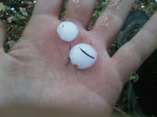
There was a light rain falling as we started hiking, as if Oregon wanted to welcome us back to our home state. The clouds rumbled with thunder. Thirty minutes into our hike lightening struck one-quarter of a mile from us, and hail a quarter inch (at least) in diameter started pelting us. We took shelter under a small tree while we waited out the heaviest part of the storm.

About twenty minutes later, the hail had passed, and the lightening seemed to have died down (at least in our neck of the woods). We continued our hike. The rain pretty much stopped, and we were left in a quiet forest. The bugs, which usually buzz with the sort of ferocity reserved for the birth of electricity, fell silent. Birds with their songs and chatter were nowhere to be heard. The thunder had ceased temporarily, and the soil underfoot was just barely damp, cushioning and silencing our steps.

For a moment, the silence was deafening. We heard nothing, and we only had sight and smell. The air carried a semi-pungent odor; a frothy mix of damp soil, wet greenery, and electricity. It was an isolated feeling, but our sense of smell rooted us to the ground, where our sense of hearing was away on vacation.

We came upon a robin bird sitting on the trail. Unaware of what happened, we could only stand in silence as we watched it sit upon the trail, quivering and breathing, but not moving away from our approaching boots. We continued along, allowing nature to run it's course with the bird.

Miles later, and several lightening strikes later, we arrived at camp. The small spring allowed us to replenish water while we cooked and looked upon the dramatic pink-orange sky created by the collision of the setting sun and the passing thunderstorm.

Very Beautiful.


Sent via BlackBerry from T-Mobile

Sunday, July 25, 2010

The Hitching Day

Day 103-July 25th
Destination: Seiad Valley/Ashland
Miles: 6.5
Cumulative Miles: 1402

Today was about hitching. We woke, with no serious rush. After a leisurely breakfast we made a hike down the final 6.5 miles to Seiad Valley. It was all road walking, and most of that was along the Klamath River. Other than detours from the official PCT, this is the longest stretch of trail on road.

We made the whole hike without hitching, which is often a "draw" when road walking. But then again, we saw our first car when we had only one mile to go. Upon arriving at Seiad Valley we enjoyed a breakfast at the cafe and then showers at the RV park.

Close to noon we began our long efforts to hitch. We have already covered the leg from Seiad Valley to Ashland, one month ago, so we needed to find a way back to Ashland. We sat on the road next to a horse ranch, and waited several long hours before a car picked us up.

It was sad looking at the horses who stamped their feet and shook their heads to keep the flies at bay, but the flies were relentless. At times 100 or more sat across their long face, and we felt total pain and pity for them, knowing how annoying bugs in the face could be. Sadly these horses had no hands to beat away the flies, so they just stood there as the flies crawled into their eyes. It was so sad to watch.

Our ride finally arrived and drove us up the Klamath River to Interstate five, completing the first leg of our journey. We snacked for lunch at the rest stop where our ride left us, and then returned to the sweltering heat to hitch a ride up to Ashland. This wait was longer, but eventually we were picked up.

Our ride was another one of those roller coaster thrill seeking demon driven cars. Driving 80-90mph down the highway, we made it to Ashland in no time. We had the driver drop us at Callahans Lodge, a restaurant/lodge on the outskirts of town known for it's hospitality to hikers. We enjoyed a free beer (kindly given to all thru-hikers) with our dinner and retired to our tent which was strangely placed in the lawn outside the lodge, where all patio/porch diners could look down upon.

Tomorrow morning we'll head into Ashland for a few small errands and then return to the trail.

Hiking for a cause
Visit our blog to find out how to donate
http://northboundheartsong.blogspot.com

Sent via BlackBerry from T-Mobile

Saturday, July 24, 2010

Sometimes Nature Comes When Nature Calls

Day 102-July 24th
Destination: Grider Creek Camp
Miles: 20
Cumulative Miles: 1395.5

We woke up this morning to find that the bears had paid us no attention thankfully. We had good rest, and only 20 miles to do today. After a couple miles we reconnected with Weather Carrot who we would hike most of the day with, taking breaks together in the shade, and eating lunch next to a stream.

Today carried fairly easy miles, in the sense that the trail was not rocky, and there was little climbing to do. But it did get hot today, especially as we dropped in elevation close to 5000 feet. Furthermore, at times our trail was so overgrown with ferns, big leaf maple, and other lush vegetation, it made it difficult to see the trail, to see if there were rocks or stumps that could trip us. We made it through without incident though, and Psycho's ankle seems to be getting better.

We parted ways with Weather Carrot not long before camp. As he is only section hiking, he does not need to maintain momentum like us. Lucky him.

Late in the afternoon nature called for Apricots, and she answered. Removing her pack and stepping a little off trail, she knelt down to find relief. In the midst of her "break", she heard a stick break and looked up. Ten feet in front of her was a bear playing peeping tom. At once she stood up and grabbed her pack while yelling down trail to Psycho. The bear fled the scene immediately running towards Psycho but down hill and off trail. He never heard nor saw the bear for he was further back than Apricots anticipated. But when he rounded the corner and saw Apricots' ashen face he knew something happened. She recounted the events, and Psycho held his tongue when he wanted to ask, "Did the bear scare the piss right out of you?"

Following the scare, we made our final mile descent down to Grider Creek Campground where we took a pseudo-bath in the creek water to wash off any oils we may have picked up from the poison oak, and our own sweat which poured like rivers out of our pores today in the muggy heat.


Hiking for a cause
Visit our blog to find out how to donate
http://northboundheartsong.blogspot.com

Sent via BlackBerry from T-Mobile
Friday, July 23, 2010

Marble Mountains

Day 101-July 23rd
Destination: Paradise Lake
Miles: 20
Cumulative Miles: 1375.5

We had a slow start this morning due to last nights commotion, yet we were still moving by 7:30. It's a good thing we were moving by then because the terrain slowed us, as well as our poor sleep, enough to limit us to 20 miles by sun down.

We started our day off with a rattlesnake, in the forest. We don't expect to see these in this area, and weren't looking for them, so it caught us a little off guard. We did see one a few days ago, but we were in hot rocky conditions, not a shaded forest. The snake did not rattle, but rather slid slowly off the trail and coiled into a striking pose. We gave it wide berth and continued our hike.

Shortly afterward we caught up with Weather Carrot who was chatting with friends of his who are south bounding a large section. We had coffee and talked while we filtered water, then pressed on. We walked across several crystal cool streams that cascaded over the trail and down the hill.

Late in the afternoon we reached Black Mountain, a rocky peak of marble. The white marble runs about 600 feet deep at points and is filled with cracks and fissures which make several dark caves. A few miles later we arrived at Paradise Lake. We did not have much daylight left so we opted to camp here.

We only hope that the frequent use of this sight will not put us at risk of losing our food to bears. After dinner we bagged our food and hung it from a tree, which hopefully will keep it protected. Now we just hope to have uninterrupted sleep, with our food still around in the morning.


Hiking for a cause
Visit our blog to find out how to donate
http://northboundheartsong.blogspot.com

Sent via BlackBerry from T-Mobile

Thursday, July 22, 2010

Testing out the ankle.

Day 100-July 22nd
Destination: 2nd Saddle Past Cub Bear Spring
Miles: 9 (plus 0.4 side trail)
Cumulative Miles: 1355.5

"Climb the mountains and get their good tidings. Nature's peace will flow into you as sunshine flows into trees."
-John Muir

One hundred days, and we're barely past the half-way point. This means that at our current average pace, it will take us nearly 200 days to complete this thru-hike. We were hoping to take 154 days at the bare minimum, maybe as much as 168 days. What this means is that we need to average about 23 miles a day to finish on time. To date, we have averaged around 14. Of course our skipping and flipping have added unnecessary zero days to our adventure, but we are done with that (for the most part).

When we woke this morning we had the dilemma of trying to figure out if Psycho should rest his foot for a whole day, or just part of the day. We also had to figure out how to get back to the trail where we jumped off. It would be a difficult hitch, first down a lonely highway, then down an even lonelier back country road.

First, we decided a good half day of rest would be good for Psycho's foot, followed by easy hiking days. We planned our food accordingly. Outside the grocery store someone offered us a ride up to Etna summit, but we declined, as we needed to go back to where we jumped.

Later when we were eating lunch at the Etna Brewery, another person offered us a ride, which we declined for the same reason. All the while, Apricots was having a funny feeling about the 20 mile section between where we jumped and Etna summit, where we had repeated offers for rides. Psycho was taking it easy on his foot when an old hiking friend, Nabor J, called to offer condolences and advice. He stated that the 20 mile section through the Russian Wilderness was very rocky and it would be unwise to take a sore ankle across the crooked terrain.

Packed up and sitting on the highway, trying to hitch a ride, we waited out in the heat of midday. After being unsuccessful for so long, we assessed our likelihood of pulling both hitches before the sun set. The day was getting late, and things looked grim. Several factors stacked up:

1. A forecast of a steep snow patch, slightly dangerous.
2. Three rides offered to Etna Summit
3. Apricots' "feeling"
4. Nabor J's advice
5. Unsuccessful hitching

We decided to bail out on the 20 mile stretch and head towards Etna Summit. We stopped for milk shakes in town and then hit the road with our thumbs. Within ten minutes we had a ride up to Etna summit, and those who passed without giving us a ride all gave apologetic faces.

The man who gave us a ride was a 90 year old rancher who was heading up to do a small hike of his own. He was great conversation, and full of love for nature. He said, "The trails through the forest are the aisles to God's Cathedral."

Dropped at the trail head we made a short 7.5 mile hike to Little Cub Springs and set up camp after sunset. Shortly after dinner we heard a bear which we scared off. Ten minutes later the bear (or another) came back. Only this bear did not run when yelled at. We banged pots together and yelled at it. His eyes reflected silver-green in our head lamps while he walked back and forth. Only after we really started making noises and yelling did he leave, and not too fast at that.

Rather than facing more bear problems through the night, and perhaps losing our food, we chose to leave the campsite and hike to a less frequented site. We packed up quickly and walked 1.5 miles down trail. We passed a snake on the trail and several spiders, whose eyes reflected our head lamps.

We found a decent flat spot at a saddle, complete with a tree to hang our food off of. We set up camp and now have crawled into our sleeping bags again, this time a little before midnight, several hours later than we usual do.

The ankle did okay today, no shooting pains, and only the occasional warm reminder of a past injury. We'll see how it holds out tomorrow, for a longer day.
Sent via BlackBerry from T-Mobile

Wednesday, July 21, 2010

The Ankle Issue

Day 99-July 21st
Destination: Forest Highway 93
Miles: 15.5
Cumulative Miles: 1346.5

The morning started with a beautiful climb up and over a ridge red with iron rich mafic rock. As we approached the ascent, we were offered a brilliant display of color, from the rich green meadow below to the soft blue sky, with a rusty red mountain between the two splattered with patches white snow reflecting the sun leaving the hillside looking like silver gilded rock. Forest green trees held infrequent bursts in this menagerie of color.

After our ascent over the ridge, we dropped into the shaded forest, where firs offered us reprieve from the generally unrelenting sun. Occasionally the trail would hit a small saddle, where expansive views of the valley below were offered.

About a week ago, while hiking in the Desolation Wilderness, Psycho rolled his ankle a few times in the day. This is a common occurrence, and the reason he chooses to wear boots rather than shoes. This time, however, he seemed to hurt himself a little more than usual. Taking a break from hiking while traveling north from Echo Lake back up to Castle Crags seemed to help a little, but to be safe, he is wearing ace bandage around the ankle.

Yesterday he noticed a little pain on his achilles tendon, and blew it off as just a bruise from the ace bandage. This morning walking was just fine, easier than yesterday. However, just before lunch he started experiencing pain in his achilles, sharp shooting pain. We took lunch at a refreshingly cool stream, after covering 14.5 miles. When we started moving again, the pain was present, sharp, and frequent.

Psycho trudged slowly up the mile ascent to the forest highway, and upon arriving explained his pain to Apricots. This time the road had a new meaning:

1. Do we hike past
2. Do we hitch to town a day early

Apricots said that it was better to hitch down and rest the foot, better than hiking on it and perhaps injuring it more. While Psycho wanted to endure the pain and walk on, he wanted to rest it more than anything, and we were at a place where that was an option. We chose to hitch.

The first car going the wrong direction provided a touch of comic relief. The small red truck came to a skidding halt on the wrong side of the road. Before it was even stopped, the door was open and the driver was half out of the cab. He jumped out quickly, crowbar in hand, and ran into the forest sliding quickly down the steep embankment. At first we thought that the man had a bad need to dig a cat hole with the crowbar, and empty his overflowing bowels.

When he ran back up the hill, we discovered that this was not the case. He was uprooting a mustard plant that is an invasive species. Apparently they spray weed killer to keep the plants down, and he (and others) have agreed to uproot all sightings of the plant to keep the weed killer from contaminating their watershed. He chatted briefly then hopped in his car shooting 50 yards downhill only to repeat the process. It was a very bizarre experience to witness his repeated exiting from the truck and uprooting of the mustard plant.

We waited for a hitch on the lonely highway. The first truck pulled over to tell us that he could not offer a ride (how peculiar). Forty minutes later, the second truck pulled over and gave us a ride. Upon arriving at Etna, we immediately hit the post office and did a mad exchange of items to mail ahead, mail home, and keep.

After a shower at the Hiker Hut (a pseudo trail-angel/Bed&Breakfast combo) we went to dinner at the Etna Brewery & Pub...a must stop for thru-hikers. Now as daylight fades, Psycho is icing his ankle while we discuss how to carry on with our "Extreme" adventure.
Sent via BlackBerry from T-Mobile

Tuesday, July 20, 2010

Half Way!

Day 98-July 20th
Destination: MM 1571ish
Miles: 24.5
Cumulative Miles: 1331

Some days start out looking easy. Long flat miles, frequent water, and imperceptible grade changes. Very often these types of days, although rare, turn out to be easy. However, sometimes this is not the case. Upon putting our boots on in the morning, it became evident that we just weren't "feeling it."

This dictated our day. With frequent breaks, and sore feet, we moved slowly through the "easy day." Near the end of the day we chose to stop one mile shy of our goal. This, however, still put us past the halfway point of the entire trail. We celebrated with a couple mini bottles of Henessey Cognac provided by Psycho's parents.

At the 20 mile mark for the day we intersected a small highway. We were faced with the dilemma every thru-hiker faces upon reaching a road:

1. Do we walk past
2. Do we hitch to town for a quick bite, and then hitch back
3. Do we hitch to town for an overnight stay

And the worst

4. Do we "get off the trail" permanently

The road, and the town at the end of it held a haunting allure that caused us to take a break for nearly an hour, discussing our options. Showers, beer, burgers, pizza, and laundry all beckoned for us, but eventually we overcame the call to town, and moved slowly trudgingly onward. We will get to the town in due time. We walked on, casting fleeting glimpses at passing cars, hoping one might stop and "change our path." None did.

We climbed 1200 feet to a water source, and chose to set up camp. Tomorrow looks a little harder, but perhaps our bodies will be feeling better.


Sent via BlackBerry from T-Mobile

Monday, July 19, 2010

A Ridge Walk

Day 97-July 19th
Destination: MM 1546ish
Miles: 24
Cumulative Miles: 1306.5

We slept in two hours this morning. Our bodies needed to catch up from the lack of sleep yestereve. Fortunately, the day was relatively easy so we were still able to make decent miles.

Our walk followed a ridge most of the day, occasionally dipping down off the top to pass by some water sources. This was a welcome drop, as we had a small scare in the morning. Our first water source was dry, and we were facing ten dry hot miles with one liter of water between us. We had to stop and melt snow, as their were no runoff streams and the snow was melting into the soil, to emerge as a spring some place far down hill.

Late in the afternoon, while crossing a large rock slide we saw a deer. The deer looked at us and either decided we were not a threat, or realized it had nowhere to run. It would easily have hurt itself if it left the trail, as large granite boulders teetered precariously on one other flanked the trail. The tread itself was somewhat difficult to walk on, so the deer just casually sauntered ahead of us for several minutes. We didn't want to scare it into running on dangerous ground, so we slowed our pace until the deer found her own way off the trail.

Not long after seeing the deer, we passed Deadfall Lakes. Ten minutes past the lakes, we ran into a family out on an overnight hike. The two girls jumped happily along the trail. Their less then eight years of age bodies free of the burden of packs moved effortlessly and happily. Pulling up the rear, and asking, "how much further," was their father who was carrying a pack overrun with all the gear. The extra sleeping bags and pads pounced along as he trod slowly up. Surely he collapsed at Deadfall Lakes before doing anything.

A few miles later we found camp atop a ridge freckled with tiny yellow flowers and a stunning view of Mt. Shasta as the sun casts red hue across the snowless patches.


Sent via BlackBerry from T-Mobile

Sunday, July 18, 2010

The No Sleep Hike

Day 96-July 18th
Destination:
Miles: 16
Cumulative Miles: 1282.5

The train departed just after midnight, and we settled into our seats that make first class flying look like coach. Despite our spacious accommodations, sleep was still difficult. We probably managed two, maybe three unrestful hours of sleep before being dropped off in the cute quiet morning of the small city of Dunsmuir, on a sunday. Naturally, at 5am on a Sunday, nothing is open, so we walked to a Chevron, waiting for it to open at 6am, so we could get some coffee and muffins.

After we ate, we realized that we were still too tired to hike, and no one was up yet driving to pull a hitch from to the trail. So we wandered down to a semi-secluded park under the freeway to take a power nap. Psycho lay awake, just enough coffee consumed to prevent sleep, while Apricots took half of a power nap. Around eight thirty we went back to try our thumbs at hitching.

Since we were on the far end of town, we doubted we could get a ride south. We chose to walk to the southern end, in hopes that our luck would be better. While walking across town a woman returning from her morning walk asked if we were thru-hikers. After telling her that we were, she offered us a ride back to the trail. What luck! Hitchhiking on the interstate is nothing shy of difficult.

Well, it would seem that hiking uphill in the heat of day on three hours of sleep is nothing shy of difficult as well. The trail started out flat with very easy grade and tread through douglas firs and incense ceders, and the day was looking up despite our lack of sleep. But after eight miles, we began a serious climb on exposed trail. The sun was cooking us, and the climb was steep.

There was an onslaught of bugs which hover in front of your face for five seconds before dive-bombing your eyes like some sort of kamikaze pilot. It was necessary to constantly swat at the air in front of our faces, or else we would have bug guts in our eyes or mouth. It is tricky doing a steep climb and breathing only through your nose, but it was necessary. Apricots "ate" five of these pesky creatures today.

Fortunately, the view was fantastic. We climbed the hill with constant picture perfect views of the rocky spires, Castle Crags. It wasn't long before we climbed out of the live oaks (and bugs) and made our way into sparsely populated Ponderosa and Sugar Pines. The hillside was dense with Huckleberry Oak.

Near the end of our day, we filtered water from a spring with Pitcher Plants, glorious insectiverous plants that help limit the quantity of bugs by eating them when they get trapped in their sticky pitchers. The Pitcher Plant has a small zone of where it grows, so seeing them is a welcome treat.

After dinner, we climbed another 3/4 of a mile to a small saddle with views back to Castle Crags, and to Mt. Shasta. We called for an early day, as we were beat from poor sleep. Tonight we hope to get good rest to set us up for a decent day tomorrow.
Sent via BlackBerry from T-Mobile

Saturday, July 17, 2010

The Train North

Day 95-July 17th
Destination: Sacramento
Miles: 0
Cumulative Miles: 1266.5

Tomorrow is Robin's birthday. It would have been nice to linger around for it, but the trail beckons. We took her out to lunch as a gift, but our visit was more than enough for her.

We took two naps today, and Psycho iced his ankle a bit, before heading to the train station to catch a midnight train to Dunsmuir.

Rest is nice, but it can't last forever. We are now sitting at the train station waiting for our five hour ride. We will arrive at 5am, eat a breakfast, and then continue our Northbound Heartsong. Hopefully we get good rest on the train tonight, or else the hiking will be hard tomorrow.
Sent via BlackBerry from T-Mobile

Friday, July 16, 2010

Zero in Rocklin

Day 94-July 16th
Destination: Rocklin
Miles: 0
Cumulative Miles: 1266.5

A day of rest.

Psycho's sister, Robin, picked us up yesterday and brought us to her apartment where we did mostly nothing but relax. We did pick up a new pair of boots for Apricots and replaced her trekking poles, which seemed to be collapsing several times per hour.

Robin prepared a tasty dinner for us, which we enjoyed while hearing stories of her latest Air Force deployment. It would seem that while we were enduring wind and sand, so was she.

Tomorrow we will relax all day before heading to Sacramento to catch a train north to Dunsmuir. We had hoped to head north today, but the train was booked up, and the bus could not get us where we needed to go, nor could it get us to a reasonable place to hitch from at a decent hour. Oh well, the extra day is needed so Psycho can elevate and ice his swollen ankle.

Sent via BlackBerry from T-Mobile

Thursday, July 15, 2010

Old Station - Echo Lake Photo's

On our 2010 PCT Thru Hike Attempt, we have bounced around the trail a lot... but that doesn't mean that the scenery is any less beautiful. This is a collection of photo's taken between Old Station and Echo Lake.

Traveling to Rocklin

Day 93-July 15th
Destination: Rocklin
Miles: 0
Cumulative Miles: 1266.5

Apricots and Psycho have decided to face the Sierras in late August or early September. The reports have been generally good, but the stream crossings seem to still be difficult, and the snow is still overwhelming. While it would be nice to keep plugging south back down to Independence, Psycho has family near Echo Lake, which makes this an ideal spot to jump.

As it stands, our topsy-turvy flippy floppy plan will take us back to Castella, CA, where we will finish Northern California, and then a short hop to Ashland, OR, so we can hike across Oregon and Washington. When we reach Canada, we will come back and hit the Sierras.

So...that's our plan (and we're sticking to it...we hope).

Sleeping in until seven this morning was great. Not having to pack up immediately was better. Not needing to hike 20 miles was even better. Having an all-you-can-eat breakfast was the best. Old Scout, Psycho, and Apricots huddled over their plates mowing their way through french toast, sausage, yogurt, fresh fruit, oatmeal, and cereal while several lively kids at Berkely-Echo Youth Camp milled about, eating one or two of the above items.

After breakfast, we packed up and went down to the general store to hang out and wait for the arrival of Psycho's sister (who lives 2 hours away). When she arrived, we all had milk shakes for the drive. We took Old Scout down to South Lake Tahoe, as we are parting ways with him now. Then we turned around and made the drive to Rocklin, CA.

We were treated to dinner by Robin and Michael after they drove us around helping us with our chores. We picked up new boots for Apricots at REI, and replaced her defective trekking poles. We also bought a new sun shirt for Apricots.

Now...
Getting north?
Sent via BlackBerry from T-Mobile

Wednesday, July 14, 2010

Desolation at It's Best

Day 92-July 14th
Destination: Echo Lake
Miles: 20
Cumulative Miles: 1266.5

This morning we woke to copious amounts of mosquitoes who waited out the night for one sweet drop of blood from our wary bodies. We ate quickly, and packed faster, starting our day with a simple log crossing over the placid Phipps Creek. Psycho had rolled his ankle three times yesterday, and so he was moving slower today.

Once across, we began our slow steady climb up to Dicks Pass. When we reached 9000 feet, the snow began obscuring the trail. Fortunately, footprints guided us up to the pass. Unfortunately, it was hard sliding across the snow for Psycho, his ankle warm with heat and tenderness. Oddly though, we lost the trail where there was no snow. The glaciers had removed most the dirt in the area, thus leaving a trail across vast glacial polished rocks, at times difficult to follow. A quick study of the map and land guided us over the pass, dropping us into the stunning parts of the Desolation Wilderness.

While it is called "Desolation", it is far from it. Being one of the most beautiful wildernesses on the trail, if not The Most, the area was packed with section hikers, day hikers, thru-hikers, and Tahoe Rim Trail hikers. Our day was spent repeatedly passing other hikers. We ran into a few thru-hikers we had known from earlier in the trail; Fidget, Johnny Law, Missing Link, and Slim Jim.

We passed lake after isolated lake, with a thousand flickering celestial constellations painted briefly across their surface. Their rich blues and silent greens contained deep secrets, if only you could stare into them long enough. We took lunch at Aloha Lake, perhaps the Hope Diamond among the entangled nest of other diamonds, other lakes. Water cascaded off the mountains into the lakes, overflowing them until they spilled water over to the next lake.

Aloha Lake lapped gently at the shore we ate at. Its cold blue mass was interrupted by a hundred granite islands, each uniquely adorned with a single tree, a clump of trees, or one solitary flower. After lunch, we made our descent down to Echo Lake.

Missing a junction, we took a half mile detour before rejoining the PCT for the arduous descent to the lake. The granite hillside had a rough trail carved through it offering a thousand different angles, bumps, and lumps to remind Psycho of his injured ankle. It seemed every fifth step gave shooting pains up his leg, until finally he screamed at the trail and threw his trekking poles at it in frustration. Ten minutes later, the trail entered forested land which was far less rocky. One hour later, we arrived at Echo Lake and bought ourselves fabulous milk shakes.

We are camping at Berkely-Echo Youth Camp tonight, a summer camp kind enough to put up thru-hikers and feed them at a small cost. Tonight is the talent show, and someone is playing the steel drum pumping beautiful tones toward our tent cabin as the sun casts its final red-gold tones on the distant peaks. The skyline above Lake Tahoe has a rich spectrum of faded blue to burnt red on the distant silhouetted Tahoe rim. The lake itself stands as a flat blue-gray streak cradled in the surrounding hills and mountains.

Sent via BlackBerry from T-Mobile

Tuesday, July 13, 2010

An Old Friend

Day 91-July 13th
Destination: Phipps Creek
Miles: 23.5
Cumulative Miles: 1246.5

Our day started with a climb to the ridge. Going back and forth through countless switchbacks, we slowly made our way back up to the ridge we had been walking yesterday. The vast serrated edge cut through the sky as far as we could see, point after rocky point. Far to the north we could see yesterday's summit, Tinker Knob.

Rocks with muted sage green lichen, and vibrant almost neon green lichen matched the sage and nearby flowers perfectly. The wind blew strong, but not hard enough to push us off the edge. It was blowing enough that it crossed our minds though, a strong gust at the wrong time could offer only fateful consequences.

As we dropped down from the ridge, over hills saturated with Mules Ears and Lupines, we ran into Uncle Tom, our old friend from the MeGaTex crew. He, and the rest of our old hiking companions had braved their way through the Sierras. We sat down and talked with him for half an hour, listening and sharing our experiences. We email our journals to one another, so we had a pretty solid knowledge on one another's experiences.

It was sad to find out that he is traveling this leg without the others. They all are playing in Tahoe, while he hikes ever onward. This means that we will very likely not get to see Train, Wizard, General Lee, and Axilla again, which is disappointing, but is the nature the trail.

We continued on, after saying goodbye to Uncle Tom, down to Barker Pass and further down the hill until entering the Desolation Wilderness. Walking through the forest, granodiorite rocks made graceful presence at first in scattered lumps, and soon in large glacier polished slabs. Unfortunately the trail is not all rock, as it passes through some boggy areas dominated by mosquitoes. It did not take long before we were swarmed immeasurably by the blood-lusting fiends.

We stopped long enough to put long sleeves and head nets on to make the hike a little more tolerable. Sunlight hitting our bug nets cast significant glare, much like sunlight on a dirty windshield. At times, when walking into the sun, it was difficult to see the uneven tread beneath our feet. Fortunately, we were only one mile from Phipps Creek, where we planned to camp.

Once at camp, we ate a quick dinner and dove into our tents to get away from the mosquitoes. As this is written, there are easily one thousand mosquitoes at our tent door, trying desperately to come in for a dinner.

Tomorrow we enter the lakes basin of desolation wilderness, which is said to be one of the most stunningly beautiful parts of the entire trail.


Sent via BlackBerry from T-Mobile

Monday, July 12, 2010

Visiting With Old Friends

Day 90-July 12th
Destination: Five Lakes Creek
Miles: 21
Cumulative Miles: 1223

Today was a day of seeing old friends and enjoying an amazing ridge walk.

We were dropped off at the trail early this morning and started the hike with a decent climb. We climbed past Donner Summit and Donner Pass, location of the ill-fated Donner Party. Down in the city of Truckee, there was a statue dedicated to the lives lost in that party. What was interesting, was that the statue stood as tall as the snowfall from that fateful winter. They could tell how deep the snow was, by the cut lines on the trees for firewood. The statue towered upwards of 30 feet.

Our climb out of Donner Pass took us up a rugged rocky granite trail. It was difficult moving, but nothing compared to what it might have been with a wagon, and stock...during winter.

Once up, we started running into familiar faces, those we had hiked with in the past. First we ran into Buckeye and Swift (Melissa+Justin). They told us they never got us a "congratulations on the engagement" present, so they gave each of us a Snickers bar as a present. Apricots replied "I think saving my life at Wright creek was a suitable present," remembering how Swift lifted her out of the creek she fell in to.

While chatting with them, The Mayor, Genius, and Daredevil walked up. We were excited to see them, and while our chatting lasted a while, we all knew that it couldn't last as long as we would like. We said our goodbyes and hiked in our separate directions. Skirting the north side of Anderson Peak, we climbed across large snow fields before making a final ascent to the ridge which delivered far reaching views in nearly all directions.

These views were not enough for us, so we stopped long enough to go summit Tinker Knob, a five minute rocky scramble to the top of the peak. At the top we could see everything for miles around. We could see Lake Tahoe, the trail behind and the trail ahead. Climbing down we tried to convince some others to go up, but they were in the thru-hiker trap of "must-make-miles-can-not-stop-to-enjoy." We all get guilty of that from time to time, but this time it was sad to see, because the climb was so short, and so stunning.

We carried on, descending from Tinker Knob and the ridge line. Along the way, we bumped into Motor Giggle Bootie Butt as well as Shroomer and Duff. Spaced apart several miles, we stopped and chatted with each of the three, sharing our stories before moving along.

Running into old friends is nice, but it makes the mileage drag through the day. Tomorrow we expect to run into our old crew Axilla, Train, Wizard, General Lee, and Uncle Tom. We are planning on eating lunch when we see them, so as to make the most of our time.
Sent via BlackBerry from T-Mobile

Sunday, July 11, 2010

The Mud Monster

Day 89-July 11th
Destination: Pooh Corner (I-80)
Miles: 18
Cumulative Miles: 1202

There are two unfortunate side effects of snow (other than the obvious difficulties of route finding and difficult walking). These occur after the snow begins to melt. One: Bugs and Two: Mud. We have been dealing with the former for some time now, but the latter has been minimal at best so far.

Where usually we have been able to sidestep the serious mud, or the trail was compacted and rocky enough that mud did not form, the conditions seemed to change today. We walked a fair amount (sometimes off trail, as the trail was buried under snow) of today on trails which flowed like rivers, and the earth around and under foot was soggy, slurpy, and suction-y.

"The mud monster tried to eat my shoe." Apricots explained as Psycho turned around to see why she shrieked.

All in all, it wasn't too bad today, but it was a definite difference from our usual run of challenges.

While filtering water and having morning coffee, a Bald Eagle swooped up the road, flying low and offering his enormous wing span as a distant graceful hug for three visiting hikers. Shortly after seeing the eagle, we saw a deer, and twice in the late afternoon, we saw a Pilleated Woodpecker.

The day was spent walking along magnificent ridges with the frequent appearance of the Mules Ears, Lupines, Indian Paintbrush, and the pine trees. At times the landscape was barren, offering moon-like rock which bled into a flowered hillside.

In the afternoon we walked past and paid a short visit to the Peter Grubb Hut, a two story hut/cabin built years ago by volunteers to offer a shelter for hikers and winter adventurers. Four miles later we were at the interstate, and Old Scout had arranged a ride for us to go to the trail angels outside of Truckee, "Pooh Corner."

The angels fed us dinner, offered showers and laundry, and have provided us a place to sleep that is free of mosquitoes (mostly).

We have passed the 1200 mile mark. :)
Sent via BlackBerry from T-Mobile

Saturday, July 10, 2010

Zeroes can't last forever

Day 88-July 10th
Destination: MM 1178ish
Miles: 20
Cumulative Miles: 1184

We went to breakfast this morning before heading out of town. The "Downieville Downhill" was about to get under way, so the streets were beginning to fill up with mountain bikers ready for competition. We ate a filling breakfast to fuel us up a hill which was not very difficult. As the PCT is a "crest" walk, most every town stop requires a descent to, and a climb out.

Today's climb was easy going, a few miles up, a few miles of roughly level grade, repeated a few times. We stopped at creeks along the way to replenish our water, resting at campsites that would be nice to linger longer at. Unfortunately, we had miles to cover and moved shortly after the water was done filtering.

We had lunch at Pass Creek, one of the larger streams that feeds the Jackson Reservoir. This particular reservoir was created in the 1800's to assist in hydraulic mining. Years after its original dam was built, a stronger dam was built to hold back more water for mining. After an unfortunate incident where the dam broke "either by accident or by dynamite" and six people died in the resulting flood, California started it's ban on hydraulic mining.

The distant whirring of boats on the lake served as a constant reminder of the not-to-distant-but-distant-enough impossibility of an afternoon swim. Psycho thought of water skiing, and his trip to Trinity Lake for a week of playing behind a boat which he did on his last hike at about this same time.

As we gradually gained elevation, the trees disappeared and gave way to hillsides covered in Indian Paintbrush and Lupines. The sweet Lupine aroma was as abundant as the wildflowers. The south facing slopes were decorated in the yellow flower which blooms after the snow melt, with it's large velvety leaves. The north facing slopes, where snow melt was slower had the early sprouts of velvet leaves, but nearly no wildflowers in bloom yet.

Where manzanita has been present for the entire hike, the sage has not. We re-entered sage country, and had hills which had small soft sagebrush growing all over the hillside in frequent patches.

Towards the end of the day, we started running in to a few more northbounders, including one friend, Goldenchild ( http://aslowbeginning.blogspot.com ). We congratulated them all for making it through the Sierras. At this point, mileage-wise, any hiker we pass is behind us in overall distance covered. This helps give us a measure of where we stand in the line of possible completion.

Tomorrow we will likely be back in snow, but forecast has it patchy at best. We'll see...

Tonight's mosquitoes were annoying...wonder if it'll get worse.
Sent via BlackBerry from T-Mobile

Friday, July 9, 2010

Zero in Sierra City

Day 87-July 9th
Destination: Sierra City
Miles: 0
Cumulative Miles: 1164

We rested today. We ate today.
That is all.

Fleeing Calpine, and it's sub par lodging accommodations, we returned to Sierra City for breakfast, as the town of Calpine had literally no breakfast options.

We napped most of the afternoon, slowly working through menial town tasks.

The proprietors of the Red Moose Cafe spoiled us to BBQ ribs for dinner. We spent the evening chatting with two other hikers "Sub Zero" who we met at the ADZPCTKO back in our first week of hiking, and "Yeti" an israeli hiker with a fierce sense of humor.

Tomorrow we return to our work, nomadic living.

It was so nice to have a full zero.
Sent via BlackBerry from T-Mobile

Thursday, July 8, 2010

Down to Sierra City

Day 86-July 8th
Destination: Sierra City
Miles: 7 (plus 1.5 road walk)
Cumulative Miles: 1164

We woke before the alarm this morning, as if our bodies were telling us that we were only a few miles away from a shower, a few hours from "real" food, a few switchbacks from a well deserved break from our constant migration. After our morning breakfast, we set down the hill. As we descended the hill, we watched the rising sun cast golden illumination on the hills across the valley. The shadows crept slowly down the distant hillside slowly out pacing us on the race to the valley floor.

The seven mile descent of roughly 2500 feet took us past the south side of the Sierra Buttes, magnificent rock towers reaching skyward while crumbling over time downward. The rocks scattering endlessly across the trail, leaving what looked like petrified splintered wood shards to walk across, clinking in the familiar glassy tones.

Halfway down, we ran into a large collective of northbound thru-hikers. Passing useful information to the 12 of them, in exchange for their own notes on our trail ahead, it was nice to catch up with some old friends, if even only for a brief moment. To date, we have passed 25 hikers who went north all the way, some 200 miles ahead of us, some only 30 in this 2600 mile journey.

We dropped off the rocky slopes into the shade of the forest, just as the heat of the day picked up. The pines offered adequate shade through the countless switchbacks down to the Yuba River valley, where we walked the 1.5 miles down the highway to Sierra City (as we were unlucky in hitching to town).

We ran into Darko and Passant, a couple we had briefly hiked with in Southern California. While talking with them, Old Scout walked up and told us that we were free to shower at the Red Moose Cafe, an Inn that is not yet open, but offers up services to hikers while it is in it's state of restoration. Despite the fact that we are not staying there, the proprietor let us use the shower, and provided us with gatorade. She even offered to feed us, but we already had our eyes on the menu across the street. We plan on staying at the cafe tomorrow. We would have stayed there tonight, but we were tied to a reservation at another hotel.

While waiting outside the laundromat for our clothes to wash, Psycho picked up the resupply at the post office. Waiting there was a care package from Adrienne and Barbara, two former coworkers of his. Excitedly, we opened the package which "rocked our world" with chocolate, liquor, toilet paper, wet wipes, bug deterrents, game books, and other fun and tasty delights. (Thank you very much Adrienne and Barbara).

Sitting on the porch to the general store while the laundry dried, Apricots sat on a bench too high for her. Feet swinging back and forth under her, she consumed a popsicle to quell the heat of the day.

Sierra City's lodging was booked for a bike race, so we booked a room at the neighboring town of Calpine. After arriving at 3pm, we found the lodge "closed." Old Scout rustled up some service, and we checked into the sort of hotel that leaves you with a creepy feeling of little kids on "Big Wheels" and elevators that "gush" blood.

Dinner was mediocre at best. The room was small, poorly ventilated, and quaint at best. However, our bodies needed the rest, and the bed provided what we needed. Tomorrow we'll return to Sierra City for a better restful experience.
Sent via BlackBerry from T-Mobile

Wednesday, July 7, 2010

That's Why We Hike

Day 85-July 7th
Destination: MM 1204ish
Miles: 20
Cumulative Miles: 1157

We woke this morning to an early climb. Very quickly the trail disappeared behind the snow. While it was not too difficult to figure out where to go, it was reasonably difficult to cross the steep snow fields and patches. Old Scout led the way, but Psycho held back to help cut deeper footholds for Apricots. Climbing up, we were faced with the usual difficulties, but had a slightly new one: collapsing snow bridges.

We reached a point where the melting snow had formed a cascading creek beneath the snow we walked upon. It was necessary to take large steps, or even leaps to get across a weakened snow bridge, lest we break through and turn an ankle on the rocky stream below.

Nearing the top of our climb, the trail was lost under snow, so we chose to cut straight up the slope (off snow) to the saddle the trail went over. We took a short break at the top of the climb before crossing snow fields and navigating our way down. Once out of the snow, we followed a beautiful ridge, which definitely left us feeling like we had returned to the Sierras. Wild flowers bloomed richly across the hillside. Vibrant yellows to faded dusty yellows mixed with deep blue and violet flowers. Rich red Indian Paintbrushes made frequent appearances between all the other flowers.

As we began to climb again, we were met with more snow. We pulled out our traction (StablIcers) and put them on our feet. The remainder of the day consisted of a constant bouncing between snow and rocky terrain. We were frequently walking across the snowless trail with our traction on, so as not to stop repeatedly to put them on again, off again. The click-grind of the metal spikes on the rocks sounded as a horse's shoe might as its hoof ground it's way across the terrain.

While enjoying our lunch at the top of a crest with a great view down to Gold Lake, we watched clouds forming what appeared to be something quite dangerous. We finished our lunch, and walked south into the clouds. Soon thunder began to rumble, and we were stuck on a ridge. Either side was steep and generally snowy, and we had eight miles of ridge walking in the other two directions. Then the lightening came, and though it was far off, there is nothing that motivates a hiker to move quick like the possibility of being struck by lightening (except maybe "town food").

Old Scout and Apricots were moving, but not fast enough for Psycho. "Move Faster! We are on an exposed barren ridge and lightening is striking nearby," pleaded Psycho as he quickly trod down the trail. Apricots later commented that Lightening is the only thing that motivates Psycho to move.

As the grumbling clouds died down, the rain started to fall. We paused long enough to put on our rain gear, but hurried to keep moving, as we were still atop a ridge, and the clouds still moaned of their trapped energy.

Nothing tells the weather to rain quite like washing one's car; and it would seem that putting on rain gear causes the weather to get nice. Twenty minutes after we donned our gear, the storm passed, and we were taking it off so our bodies could breath again.

As we neared the end of our day, we bumped into a Boy Scout troop, which had hiked the same leg we just did. It's hard to hike what we did, and even harder to imagine doing it as a teenager, or being the adult responsible for safely guiding several young boys through it. After meeting them, we saw another hiker, who had been caught in the center of the lightening storm. After lightening struck twice within 40 yards of him, he dropped his pack and ran down the mountain. He was on his way back to go find his pack.

At the final water source for the day, shrouded deep in the forest, we asked Old Scout to go find a campsite with a view. It was said as a joke, as we expected nothing but trees, but one quarter of a mile down the trail, the trees opened up, and we were given one of the most amazing campsites of our entire trip. Nearly 360 degrees of scenic mountains.

And while we struggled through most of our day, Apricots saw fit to point out, "This is why we do it."


Sent via BlackBerry from T-Mobile

Tuesday, July 6, 2010

A Good Day (maybe it was the advil)

Day 84-July 6th
Destination: Nelson Creek
Miles: 21
Cumulative Miles: 1137

As Apricots is always pushing miles (like a dedicated thru-hiker should), we woke early and packed quickly. In our morning haste, we temporarily lost the trail and walked a quarter mile down the wrong trail. Rather than backtracking, we cut cross-country back up to the trail. Dry fallen branches snapped under our feet, leaving us with a bizarre sense of satisfaction when the larger branches snapped beneath our weight.

Once back on the trail, we passed through some beautiful fields of yellow wildflowers, likely to be in bloom only shortly after the snow melt. The tall stalks with miniature sunflower like blooms of 10-15 yellow petals sprung forth from broad green leaves. The 6-8 inch long wide leaves were covered in a fine cotton like fur, undoubtedly used for retaining morning dew. Further down we passed another plant which masters water retention with large funnel like leaves intelligently designed to capture rainfall and dew and funnel it directly to the roots.

Our hike took us up on a ridge with distant views to the approaching Sierras. From this side the snow appears to be melting, but we are still quite a distance from the high Sierras, so it's hard to get a strong gauge of what we may be facing in a couple weeks. We can rely only on the words of the northbounders we have passed along the way. So far we have passed 13, and we asked all of them to share stories of their experiences. Everything we have heard makes us thankful that we jumped, in spite of the struggles we have faced.

Late in the day snow patches appeared as we gained elevation alongside Nelson Creek. The late afternoon shadows laid across the snow causing distant patches to look like small mountain tarns through the trees. As we approached the west fork of the Nelson Creek, we found a shabby spot to lay our tent among countless twigs, sticks, and branches.

Just 27 short miles to Sierra City, where we will enjoy our first zero in over three weeks. :)
Sent via BlackBerry from T-Mobile

Monday, July 5, 2010

Back to the Grind

Day 83-July 5th
Destination: MM 1245ish
Miles: 20
Cumulative Miles: 1116

We enjoyed a large breakfast this morning, provided by the Williams, our Bucks Lake Trail Angels. Their hospitality and generosity was some of the best on the trail. After filling our stomachs to the seams on pancakes, eggs, bacon, and fresh fruit, we loaded our packs into the car. Dennis (who we met back in Belden) drove us back to the trail.

Once on the trail, we continued this southern leg of our hike with a small climb before dropping a few thousand feet down to the Middle Fork of the Feather River. Along the way today we met a few other Northbound hikers who have made it through the sierras and continue their trek ever northward. We were shown a video of one stream crossing that was so deep, they decided to inflate an air mattress and use it as a pseudo-raft to float across. We're hoping that future reports indicate that the water levels have dropped significantly.

With full bellies from a satisfying breakfast, we did not bother to take lunch until just after 3pm. Sitting on the rocks by the river, we had a picture perfect view of the steal bridge over the river. After lunch we made a 2000 foot climb to camp. We were aiming for 21-22 miles today, but Old Scout stopped at 20 and set up camp before our intended goal, so we decided to camp with him.

We have passed the 1100 mile mark now. Apricots has hiked more miles on the PCT with Psycho than he covered the first time around. Psycho is starting to feel the drain of the long hike, and seems to be running low on steam. We have been moving nearly three weeks without a full zero day, and it shows in our mental fatigue. A zero is planned for Sierra City to help renew our desire to be out being nomadic.

Sent via BlackBerry from T-Mobile

Sunday, July 4, 2010

Happy 4th of July

Day 82-July 4th
Destination: The Williams' Honker Pass
Miles: 9
Cumulative Miles: 1096

We had been told by a section hiker (Dennis) that his family was offering up trail magic by Bucks Lake, so when we left Belden, we planned on taking advantage of a generous offer to spend the 4th of July with the Williams family.

We set no alarm this morning, and instead just woke when our bodies let us. We heated water in the morning for hot coffee and hot oatmeal, which is rarely done. We then made a short 4.5 mile hike down to Buck's Lake Road, where we met Nancy Williams. She took our packs and agreed to meet us two hours and 4.5 miles later at Big Creek Road.

Sadly, on the walk down, we met a day hiker with two dogs. One of the dogs jumped up on Apricots, tearing the earpiece to our newly acquired mp3 player out of her ear. The dog succeeded at maiming our earphones, so that we now have only one functioning headphone. Despite Apricots' refusal of money, the woman insisted she take some to replace the headphones, so we will replace the headphones whenever we get to a town that supplies them.

We then made the short slackpack between the two roads, facing no snow and only about thirty blowdowns. Along the way we met our first full blown northbound thru-hikers who had made the full trek through the Sierras. By our calculation, this puts the five of them about nine days ahead of us mileage wise. We shared trail conditions and listened to their horror stories of neck deep stream fords, and trail blazing through pristine snow.

Upon arriving at Big Creek Road, Nancy was waiting for us to take us down to her cabin (Honker Pass). Once there, we did our usual town routine of showering and laundry. Then the relaxation began. They showered us with food galore, as it was their 4th of July celebration. We enjoyed burgers for lunch, then took a nap, and woke shortly before a fantastic feast of a dinner was served.

We plowed through large salads, pasta, rice, and steak before indulging on multiple servings of delicious dessert. We talked with all the family that was up for the holiday, while the multitudes of children ran about playing ping-pong, hammock swing, and musical instruments. Briefly Nancy played some pseudo-patriotic music for us on her accordion.

As the sun set between the trees, smoke lingered in the air from all the campfires built by neighbors up for the holiday weekend. At nine miles, and a very restful day, we just might have gotten the rest we so need to continue on. Our schedule is still very tight though, and we need to keep moving, long and fast.


Sent via BlackBerry from T-Mobile

Saturday, July 3, 2010

Big Climb, Big Climb, Don't you want to do a Big Climb

Day 81-July 3rd
Destination:
Miles: 16
Cumulative Miles: 1072.5

We were treated to a nice breakfast at "Little Haven" just outside Belden before returning to the trail for a big climb. (Thank you Braatens for the hospitality).

We dragged our feet because we knew we were facing one of the biggest steepest climbs of the entire PCT. It held a grade 2-3 times steeper than the usual grade of the trail, and climbed close to 5000 feet in less than eight miles. Our packs were loaded full for a 5-6 day leg to Sierra City, and the climb was waterless, so we were packing heavy water loads.

After a quick stop at the store, we donned our packs and made the ascent, which turned out to be easier than expected, but it would be a lie to say that our legs didn't quiver with fatigue for perhaps the first time on the trail. As we made our climb, we were dropped into a treeless stretch which offered amazing views in all directions. The trail was dense with ferns, and even thicker with the rich green smell of the plant.

We took lunch two-thirds of the way up the climb. Stunning views in all directions, and more hill to climb. At times the hillside was so steep, it was a wonder any vegetation grew at all. As we finished our climb, we were offered a few flat miles with wide even tread making our walk simple, and allowing our bodies to catch a break before we climbed up into the snow.

Taking a rest at a stream ten miles up, we filtered water before moving along again. Five hundred feet further, we were met with a creek which required us to stop and take our shoes off to cross.

While the snow was fatigueing, the trail was easily found allowing us to move at a decent pace. As we neared the top of the ridge, which we walked along for the remainder of the day, we looked down upon Silver Lake, a mid-sized lake complete with an island in the middle of its blue waters.

Trudging over the snow, we bumped up and down all the small crests of the ridge until finally arriving at our camp. Not long before reaching our site, we noticed mountain lion prints in the snow, just beside another person's tracks. It was evident the hiker was being tracked out of curiosity by the cat. We wondered if our prints would soon be greeted with the paws of another mountain lion.
Sent via BlackBerry from T-Mobile

Friday, July 2, 2010

A Day of Challenges

Day 80-July 2nd
Destination: Belden
Miles: 16
Cumulative Miles: 1072.5

It would seem that the trail is doing whatever it can to make us struggle. Yet, in spite of our struggles, we still choose to continue in this "heavenly torture."

Our first struggle - Getting up this morning. We have been going for sixteen days straight without a zero, and our bodies need the rest. This makes it harder to get up in the morning, but we need to make the miles, and Belden beckoned.

Our second struggle - An uphill climb in the snow. We had a ridge to climb over, and the trail was buried under the snow. We had to climb while navigating our way over five plus feet of snow. With the trail completely hidden, we slowly chipped our ascent up the hard snow.

Our third struggle - A downhill climb over a trail obscured with snow and blowdowns. Once again, we were required to use our GPS to find the trail. Looking at the map, it was easy to predict where the trail went, but we used the GPS to help, as we held hopes that the trail would unveil itself. Eventually the trail appeared, but not until we had trucked over two to three miles of solid snow.

Our fourth struggle - A trail obscured by several creeks. Once the trail was found, it decided to be overrun with several snow fed streamlets. Walking back and forth over mushy land, the hillside was inundated with water, creating several false trails. With a little work, and a lot of mud, we found the trail.

Our fifth struggle - Two stream fords of Chips Creek. As far as stream fords go, this one was not too difficult. It was bothersome to be required to cross it twice, but not too hard. The first crossing was done rather simply, and the second was made slightly difficult by the blowdown in the middle of the crossing. By now, though, we have mastered climbing over blowdowns, so we scaled the fallen tree midstream with ease.

Our sixth struggle - Incredibly rocky terrain. The trail down to Belden was a long drop, interrupted by viciously bumpy tread. Our fatigued feed kicked stumbled and rolled over jagged rocks littering the trail.

Our seventh struggle - Hot muggy heat in a burn zone in mid afternoon. As we made our final descent into Belden, we passed through an exposed burn zone, with very humid heat. While it was muggy at times, we did have a decent breeze which blew often enough to keep us cooled.

Our eighth struggle - Blowdowns. Trees over trail, trees over snow, trees over creeks, everywhere fallen trees.

At the end of the day, we just needed some sort of hiker haven, a place welcoming to trail worn hikers, a place where we could shower, and wash our wounds. We arrived in Belden, a tiny town in the middle of nowhere, famed for its "Raves." We went to the restaurant/store and bought ice cream treats and cold drinks.

While enjoying a drink, Brenda a trail angel walked up and offered us a ride to her house - "Little Haven" - another hiker retreat, a place of rest, a place to shower, and a place to eat before shipping out for our next leg to Sierra City.

The trail angels are dense in this area of the trail, and for that we are very thankful. We have been enduring some of the hardest days on the trail the last two weeks, and any bit of trail magic we get restores us and inspires us to continue.
Sent via BlackBerry from T-Mobile

Thursday, July 1, 2010

Lumpy-Volcanic

Day 79-July 1st
Destination: MM 1305ish
Miles: 21.5
Cumulative Miles: 1056.5

Snow, bugs, and downed trees really take it out of you.

We rose early to ensure that we made adequate mileage today. We have food enough to last us this leg, provided we aren't slowed too drastically by obstacles. Today's obstacles slowed us down a bit, but not too much.

Starting at the snow line, we climbed roughly 1000 feet, skirting the top of Butt Mountain, before following the ridge south of the mountain. The snow, fortunately, was patchy lending itself to easy trail finding. As we regrouped with Old Scout and Compass we navigated our way through the only difficult snow patch of the day, approximately one mile with no signs of the trail.

After dropping down to a lower ridge most of the snow had cleared, and we were walking along a ridge with stunning views, and brilliant wildflowers. We met a new species of flower today which had tiny needle like purple petals, bunched densely with multiple bunches. The long flat leaves twisted outward like the tentacles of an octopus.

The hillside was covered in volcanic looking rock which had multiple round knots bulging out of it's surface. The towering rock pinnacles looked like a ghost of a breeze would cause them to come crashing down upon our trail which wandered below the rock spires.

Around lunch we left the scenic ridge and walked back into a viewless forest ripe with blowdowns and snow patches. When we weren't using our muscles to drunkenly walk across the snow, we were using our concentration to avoid the countless sticks strewn about. Stepping over downed trees, we had to cautiously lift our legs to waist height at times, carefully placing the feet on the other side. At times the soil would give way, or we would step on a stick that rolled, stealing our footing. Twice today Psycho stepped on sticks which vaulted up into his legs scraping the inside of his thigh and his knee, drawing blood like some sort of offering to the trail.

When a trail is "viewless" we must find beauty elsewhere. We find light hitting trees, highlighting the moss like a neon strip light down the edge of the tree. Apricots noticed that the moss always stopped shy of the ground several feet, and reasonably concluded that the moss probably grows down to the average snow line. We find unique trees, and padded trails to comfort us when we can't look far into the horizon. We must see the forest for the trees, lest we grow bored.

In the evening we slogged across some muddy areas where the mosquitoes were nearing full tilt, and so we had to move quickly to limit the loss of vital fluids to whining insects. Tired, we stopped shy of our goal by one mile.

Sixteen miles to Belden...we can do it.

Sent via BlackBerry from T-Mobile