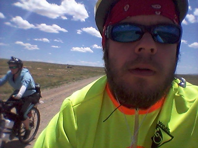
Wednesday, July 6, 2016

Why? Oming

Day 30 - July 6th
61.4 miles
Total: 1192.8 miles
Moving Avg: 7.5 mph

The day started out with a solid climb out of a very beautiful river valley. As we gained elevation, we saw a dog eyeing us on the road. After about two miles of watching us, she came and introduced herself to us. No collar, save for some green spray paint on her neck, we didn't know where her home was. She definitely has a large roaming area.

She followed us for the next six to seven miles. She even chased two Pronghorn through the shrubbery for a very fast half mile run. Eventually she came back to us. We tried to get her to go home, but she kept following us into the Great Basin. Since we were gaining elevation, it was easy for her to keep up with us.

Once we hit the downhill she had to run to keep up. Then we passed a cattleguard. She struggled to get through it, and we made our distance. A mile further down the road I looked back, and in the distance I saw her running down the road after us. Fortunately we were too far and too fast, so we lost our tail. (Unfortunately too. She was super beautiful, very calm, and would have made for the most amazing "she followed me home" story)

A couple miles later, we ran into a rancher. He spoke no english, but that didn't stop him from telling us his life story. From what we understood, he moved from Steamboat to Wyoming as the prices were unreasonable in Steamboat. He has five kids, four in Mexico, and one in California. He was out repairing the fences of his ranch.

After that conversation, we made the final descent into the Great Basin, including a four mile stretch along a road that was perhaps the least roadlike experience we have had on the trail. Apricots kept teasing me every time I referred to the path as a road. Surely it was too beat up and overgrown to be considered a path for ATVs.

Then thirty miles of nothing but unbearably bumpy straight road of nothingness. With a solid side wind.

Thirty straight miles.

The view never changed.

Thirty straight miles.

The washboard gravel was consistently bumpy.

Thirty straight miles.

Every passing truck kicked sand in the air as we closed our eyes and held our breath for a second or two.

Thirty straight unchanging miles.

Nearing wamsutter the wind was stronger, and a light rain fell for a brief moment on us. We settled into the idea of getting a hotel for the night. Tomorrow we have 92 similar miles to Atlantic City. We are waking super early to try and beat the wind.

I don't know if we will make it all 92, but we are going to try. For kicks, you should take a look at the link below to see the vast barreness of the Great Basin that we are crossing.

Time to sleep. Super Early morning tomorrow.

Live life at a slower place.

Sent From:
http://maps.google.com/maps?z=12&t=k&q=loc:41.67236+-107.98012

Into Wyoming

Day 29 - July 5th
57.6 miles
Total: 1131.4 miles
Moving Avg: 8.1 mph
Overall Avg: 6.1 mph

The good thing about sleeping behind a country store is that you can wake up to some killer breakfast sandwiches and good coffee.

The breakfast powered us up the hill to Steamboat Lake. It was too early to bother thumbing a ride over the nine miles we had already covered. Besides, we opted to take the Columbine Alternate, so the nine miles to Steamboat Lake worked better by approaching the alternate from the other side of the lake.

At the lake we opted out of getting a snack at the local store, as we knew Columbine a few miles further along had cabins, and coffee, and donuts, and yummy pleasantries. So, we cycled the rest of the way to the pass to Columbine.

Sadly, the store in Columbine was closed as it was the Monday after a holiday. No worries, we were still fueled for the downhill ride. We rolled past Colbie into the freckled sunlight of a million Aspen. It was a beautiful stretch of countless Aspen Grove, and classic Colorado mountain roads.

As we lost elevation, we entered into Three Forks Ranch, an enormous complex of lodges, cabins, and fishing and hunting grounds. I don't think the ranch had any cattle or horse to speak of, but they did have a lawn so large that the grounds keeper probably is continually mowing it to even keep up with the growth from end to end. The Ranch is one of those billionaire vacation spots, where nightly costs for cabins can run around five thousand dollars.

Ten miles later we exited the ranch, and hit the highway a few miles after that. In the last stretch we wiggled between Colorado and Wyoming, crossing the border five times before settling into Wyoming.

In the very small town of Savery (population 24), we stopped in at the local museum and met Lela. We had prearranged with Lela to stay at her house seven miles north of Savery.

Two chocolate milks downed in Savery, and we were on the final stretch to her home. The house was beautiful inside and out. She puts the home up on Airbnb.com if you are interested in planning a trip down to the great basin.

Tomorrow we begin the long dry stretch across the Basin. Hopefully it will be beautiful.... and not too much of the same view for miles on end.

Live life at a slower place.

Sent From:
http://maps.google.com/maps?z=12&t=k&q=loc:41.10899+-107.36697

Tuesday, July 5, 2016

Happy 4th of July

Day 28 - July 4th
41.4 miles (plus 17 backtrack slacker miles)
Total: 1073.8 miles

I could get use to sleeping in. Since we were being visited by Loren and Natalie, we opted to have a leisurely morning. Around six am, the sun woke me. We packed slowly, and eventually I woke Loren and said it was time to rise and shine.

The four of us enjoyed hot coffee while Dexter sat idly by. What an awesome bulldog. Apricots and I said our goodbyes, and thanked Loren and Natalie for helping is out and visiting us. On our way away from camp we talked briefly with other tour cyclists. Then we began our 40 mile ride to Steamboat Springs.

The ride was a very gentle grade, and we enjoyed the very nice tread we rode along. Soon enough we arrived at The Elk Run trail, a simple single track trail which runs the perimeter of Stagecoach Reservoir. It was pretty fun hitting some simple trail riding, most everything we have seen this far has been roads (although some I wouldn't take a car on). This was a pedestrian trail with light gravel, and rolling hills.

We took lunch at the Dam, and then rolled the final 21 miles down to Steamboat Springs, mostly along the Yampa river. Once in town, we stopped at rhe grocery for relaxation and resupply, then we stopped at the bike shop for a quick inspection. Everything looked great.

On the far side of town we hit the road that we came down yesterday. We were not keen on cycling 26 miles uphill, especially since we cycled it yesterday. As such, we stuck out our thumbs on the semi quiet road.

An hour plus later, a car said they would run home and grab their bike rack and then drive us up the road to Clark. We waited about twenty minutes, and they returned with a bike rack. Dropped at the store, several miles shy of our intended goal, we weighed our options. With little daylight left, we settled for camping at the general store.

In the distance we can here the fireworks. But we should be able to find sleep quickly. We have to rise before the store opens, which is good, as we have a bigger day tomorrow.

Live life at a slower place.

Sent From:
http://maps.google.com/maps?z=12&t=k&q=loc:40.70681+-106.91931

Monday, July 4, 2016

Southbound for a day

Day 27- July 3rd
28 miles (plus 58 backtrack slacker miles)
Total: 1032.4 miles

We slept in this morning. It has been a much needed rest, and the way we felt after the ride showed us the importance of rest days.

Gina and Karen continued their great hospitality by making a delicious breakfast, ensuring we had adequate water, and stockpiling a bag of treats from the sugar tray. We waited long enough for our tent to dry from the rain before setting out. We said our goodbyes and thank yous to Audrey for snagging us, and the hosts for everything else, and then set out on our way.

Our plan: cycle southbound to Steamboat Springs, meet up with an old friend who could shuttle us back to where Audrey picked us up, camp, and then cycle northbound to Steamboat Springs.

And that is what went down. We set off from our hosts, and cycled nine miles to Clark, and checked out a really cute county store / library / post office / ice cream parlour. From there. We cycled the nineteen miles to Steamboat Springs through vast ranchland and cool river valleys with freckled sunlight, where motorists share the road with cyclists.

The clouds had finally parted, just in time for the holiday festivities. Many locals (and likely tourists), were calmly drifting down the Yampa river on various flotation devices. Apricots and I made record pace into town. We then sat at a barbecue joint, waiting for Loren and Natalie to make their way into town.

I met Loren when I hiked the Pacific Crest Trail in 2005. My first hike, which covered about 1100 mikes, ended shortly after spending several days hiking with Loren and Denise (aka "Boone" and "Sas"). Eleven years later, Loren contacted me to make sure he could come trail Angel me and Apricots on our Great Divide tour.

Today, he helped out greatly. Natalie (his wife of three weeks) and Dexter, their bulldog, provided great company for our pseudo vacation from vacation. They were happy to get out of town to, as all of their pre and post wedding activities had actually prevented them from getting out for a break of their own.

They shuttled us up to Lynx Pass campground, close to where we jumped on board with Audrey. We enjoyed some wine, some games, and a campfire as the sun set. Strange enough, sometimes our cycling adventure exhausts us too much to actually sit back and enjoy the space we are in.

We consumed the wind, the trees, the stars, the clouds, the smell of campfire, and the good company to heal our energy and spirits. Tomorrow, we will sleep in and say goodbye before returning to Steamboat Springs via the official trail.

It was a lovely day. A true Colorado experience.

Live life at a slower place.

Sent From:
http://maps.google.com/maps?z=12&t=k&q=loc:40.10552+-106.68197

Sunday, July 3, 2016

Highway to Heaven

Day 26 - July 2nd
4.6 miles
Total: 1004.4 miles
(Plus 69.6 slacker miles, but we are gonna backtrack)

I woke at sunrise. The rain had stopped. It had rained all night. I had high hopes that the clouds had dumped all their water, and the day would be rain free. I gently woke Apricots, and said it was time to go. We had a choice between 16 miles of highway and forty trail miles, or 48 highway miles.

Well the shorter distance trumped the official route. We packed up, and just before we crawled out of the tent, the rain started falling. Big sigh. It was not going to be a good day. Fortunately, it was a light sprinkle, and we wanted to put as many highway miles behind us as we could before the Fourth of Julyers took over the road.

The first mile was nice with a decent shoulder. But that changed, and traffic was unusually high for six am. Four and a half miles behind us, Apricots had started inventing new swear words, and the mosquitos were already out in double droves.

We pulled to the side of the road at a turnout area. We discussed our options. Should we backtrack and take the official route? Should we hitchhike? Should we violently throw our bikes in front of a passing semi? Should we throw ourselves in front of a semi?

One thing is for certain, we wanted coffee. Apricots pulled out the bowls while I half heartedly stuck my thumb out at passing trucks. Suddenly a minivan pulled over and asked if we needed anything. I defeatedly said no. Then the driver asked if we would like a ride. Shocked at the idea that it would work, we excitedly said yes, if our gear could fit in the van.

Ten minutes later all our gear was crammed into a minivan, and we were making record pace to Steamboat Springs. Our trail angel, Audrey, was super stoked to have picked up two great divide tour cyclists. She plans on doing a 28 day south bound ride starting early August. Giddy for the potential knowledge swap, and caring for the pathetic state we appeared to be in, she invited us to her friends house.

Her friends were having a fourth of July party up at Steamboat Lake, with about fiteen other adults. The cabin in the mountains looked out on the lake, where an early firework show would be put on.

While we stopped for a fresh batch of hot coffee in town, Audrey cleared it with her friends. Then Audrey treated us to breakfast, insisting we eat as much as we could. I consumed biscuits and gravy and bacon and creamcheese french toast. Heavenly.

Post breakfast, we headed up to Gina and Karen's house at Steamboat Lake. We were greeted with warm welcomes, offers for showers and Laundry Service, and promises of amazing afternoon barbecue delights.

We socialized throughout the afternoon, and took a nap. My health neared full finally after I got a full day of rest. We consumed amazing barbecue delights and sweet treats, and b socialized into the evening.

Then an amazing storm swept into the valley. The wind whipped up to violent speeds, and rain pounded so heavily on the house, the roof appeared to spring a couple leaks. Lightening was striking less than a second away. We all jumped inside, wondering whether the weather would wipe the evenings firework show.

Thirty minutes later the storm had passed the house. In the distance we could still see solid lightening bolts striking the mountains. The pyrotechnicians jumped on the open weather window, and let the a how start. We watched explosions in the sky, multicolored blasts back dropped by the nature's own firework show.

Two simultaneous shows for our delight, in the company of good people.

Shortly afterward, we made our way to the tent. Everything inside remained dry through the storm, and we had solid rest awaiting us, after our much needed rest day.

Live life at a slower place.

Sent From:
http://maps.google.com/maps?z=12&t=k&q=loc:40.79350+-106.99451

Saturday, July 2, 2016

Highway to Hell

Day 25 - July 1st
45.8 miles
Total: 999.8 miles
Moving Avg: 9.4 mph
Overall Avg: 5.7 mph

On the bright side, it didn't rain on us.

The official route travels twelve miles down highway nine, before cutting off to the mountains and returning to highway nine again thirty eight miles later.

The weather predicted rain, and the health wasn't 100 percent, so we opted to follow the highway all the way. It would shave off about ten miles. If you haven't guessed by now, I am more than a sliver removed from a purist. I am out to bike from Mexico to Canada, mostly on the Great Divide route. Key word: mostly. I am happy to find shortcuts/easier routes.

We thought we had picked one in the highway. It would be largely downhill and paved.

Woopse, turns out that they were doing some major highway construction. After the initial twelve mile downhill section, the shoulder disappeared. We had to cycle next to crazy fourth of July travelers. Past the point of no shoulder, the paving disappeared. We had to cycle on loose mud, from fresh rain, or on the main path of travel for cars....and there were plenty of cars.

We weaved between orange traffic cones, mud which had more control over our bikes than we do, and fast moving RVs hauling cars. It was a unique cycling experience, one which I hope to never repeat. The highway reconstruction zone lasted about six miles, and we were happy to find paving at the end of it.

Nine miles later, we arrived in Kremmling, where we found an ice cream and coffee shop. How neat is that!? We enjoyed cold sweet caffeinated beverages, and planned our next course of action. The addendum to the maps discussed a portion of the trail which is impassable when wet. This is the portion we were about to embark on. Since it rained the last two days, and rain was anticipated for the next two, we were not keen on taking the official route.

The highway had an alternate which routes us past the impassable part, so we settled for more highway riding. I found a campsite six miles past Kremmling, and we were fortunate to get a reservation. I still marvel that places (with no services other than pit toilets) can charge $25 for a tent space. But, it is what it is, and it is fourth of July weekend.

We bought groceries for the short leg, and went on our way to the site. I didn't think our highway experience could get worse, but it did. Our six inches of no shoulder space turned into zero inches of no shoulder space. Our gravel shoulder turned into a grassy shoulder. Our flat shoulder turned into a bumpy steep shoulder which forced us to walk our bikes. Our weekend travelers doubled in frequency. And finally, the mosquitos decided to attack us in droves.

I haven't seen Apricots swear this much in any leg of the trail. I am truly shocked that I didn't see her throw the bike at an oncoming car and call it quits as she watched the bike explode into millions of pieces. She told me that she has no idea if the area we passed through was beautiful, because she was too busy being stressed at holiday weekend traffic. The six miles out of Kremmling have easily been the worst highway miles we have traveled.

But in the end, we arrived at camp, and set up our tent. Fifteen minutes later the rain came, and it hasn't let up for the last two hours. I am so glad we didn't have to bike in the rain.

Now.... can I get to sleep to the rhythmic beats of our neighboring RVs music?

Earplugs, here I come.

Live life at a slower place.

Sent From:
http://maps.google.com/maps?z=12&t=k&q=loc:40.14413+-106.41468

Thursday, June 30, 2016

Over the pass to Silverthorne

Day 24 - June 30th
24.7 miles (plus 56 slacker miles)
Total: 954 miles

I don't know how we managed nearly 25 miles today. I was still feeling less than perfect, and our ride into town for random groceries showed that I wasn't full strength.

We needed to get to Silverthorne today to stay on schedule. I have a friend meeting us on Sunday, a home stay scheduled for a couple days after that, and a potential home stay a few days after that. I was in no shape to ride the 70 miles to Silverthorne, and the weather was calling for rain and thundershowers all day long, not exactly what one wants when biking over a pass.

Apricots and I sat at a coffee shop discussing our options. I made a few calls to people listed with WarmShowers, a service the connects cyclists to one another for support. After going through almost all possible scenarios, we found a host in Buena Vista. I asked if we could take a rest day at his home to save money, or if he could shuttle us down the road to help us keep schedule. Mark kindly offered to take us to the top of the pass so that we could roll down hill into Silverthorne. As I was only weak, this felt like the best option.

Mark (the second Mark to help us on this trip) picked us up and drove us up the Arkansas river valley, a premier whitewater rafting river. He told us a little history of the area, and movements to turn the defunct rail line into a trail for pedestrians and cyclists. Currently the government says no, so the locals are pursuing a different option to turn an old stagecoach road into a pathway.

We passed through Granite, Leadville, and finally Climax, an obsolete town that was taken over by a giant Molybdenum mining operation. The top of the pass was a giant scar on the landscape, but still very cool to look at.

Since the rain was falling the heaviest at the top of the pass, Mark drove us a bit further to a bike trail on the other side. He saved us the burden of cycling on a highway in a rainstorm. Instead we could cycle a beautiful bike path down into Frisco, and then on to Silverthorne, all of it mostly downhill.

The rain didn't let up much, but we made the wet grind down to Frisco where we stopped in to warm up and have lunch. After lunch we cycled t he last bit down to Silverthorne, taking a winding path around Dillon Reservoir, before crossing the dam and dropping in to Silverthorne.

Silverthorne is a nice town nestled in a valley behind a giant dam. It's a little unsettling to look up at a wall of rock, knowing how much water weight is pressing against the rock. I sure hope the dam is over engineered.

In town we bought new tires for our bikes and did laundry, the had a tasty dinner at a Bakery/Brewery.

The forecast for the next few days is rain. I am not looking forward to biking in cold rain.... but we must push on if we are going to do this whole trail.

Tonight we spoiled ourselves to a hotel for solid rest. Hopefully my illness bug will have taken leave by morning.

Live life at a slower place.

Sent From:
http://maps.google.com/maps?z=12&t=k&q=loc:39.63017+-106.06622

Wednesday, June 29, 2016

Is New Mexico still chasing us?

Day 23 - June 29th
26.8 miles
Total: 929.3 miles
Moving Avg: 9.4 mph

We woke at six this morning. The room was pretty warm, but it was good to get rest. We used the kitchen in the hostel to make some hot coffee. It is nice to have such simple pleasantries, as we travel without a stove to cook our food. We eat only cold food. Unfortunately, this makes town food that much more alluring, and hard to live on a limited budget.

By seven am we were rolling down the highway toward Silverthorne. We were both wanting an easier ride, so we saw a path along a rail line that led to our next town stop. Since the highway paralleled a river and rail line, we knew the climb would be super gradual, and paved the whole way. On top of that, it passes through Leadville, CO. Word has it that this city has the highest elevation airport in the United states.

Twelve miles down the road, Apricots and I sat on a curb at a gas station eating tortillas and tuna, and drinking gatorade. I was feeling low energy so we took an early lunch at the gas station.

Twelve miles past there, I was really struggling with my energy, so we pulled into a coffee shop in Buena Vista. We had coffee and tiramisu. Amped from the coffee, we headed out of town for the final thirty five miles to camp at Sugar Loafin Campgrounds.

Two miles later, I was crashing hard, and Apricots made the executive decision to call it a day. She knew I was sick from something, and that I needed rest. We pulled into an RV park and set up camp.

I think I had some bad water, as I have been visiting the bathroom more than I should, and I was obviously low energy. I crashed in the tent, while Apricots biked back to town (in a light rain) to get me some probiotics, zinc, and grapefruit seed extract. She played doctor for me today, pumping fluids and being the awesome person that she is.

Hopefully my energy will be back tomorrow. We have a big day.

I wonder if the illness is from bad water. We did accidentally pull water from a civil tap that had warnings of e. Coli in the water.... but that was all the way back in Vallecitos, NM.

Maybe the pizza was bad food....

Maybe I am just tired from so many hard days. Maybe New Mexico finally caught up with us and is still trying to officially kill me.

Live life at a slower place.

Sent From:
http://maps.google.com/maps?z=12&t=k&q=loc:38.86307+-106.14824

The Salida Reset

Day 22 - June 28th
51 miles
Total: 902.5 miles
Moving Avg: 7.3 mph
Overall Avg: 4.2 mph

This morning we made the long gradual ascent to Marshall Pass. It wasn't slow though. The grade was a perfect grade. It allowed us to gain elevation, but not fatigue from the steepness, a near perfect 200 feet per mile for all sixteen miles. I never needed to push the bike, and the two of us only needed to take a handful of one minute breaks. If all climbs were that easy, I would be happy. On top of that, the quality of the road was near perfect with a fine gravel and hard packed dirt combination, all energy exerted moves us up and forward.

We knew that the grade going down was identical, so happiness awaited us on the otherside. A descent that is graded so there is no need to Pedal, nor any need to break. We arrived at the top and enjoyed tortillas and tuna and mayo and mustard. hose mayo and mustard packets bring dull food to life.

On the flip side we started our 25 mile descent to Salida. It turned out to be a very bumpy road for the first half. In fact, it was too bumpy to coast. As such, we ride with our hands poised on the breaks. During a particularly bumpy stretch I noticed my rear brake suddenly stopped working. Then my rear tire fell off. I heard this loud grinding of rubber on metal, and screamed "oh shit! Oh Shit! OH SHIT!"

I managed to get my feet unclipped from the pedals and on the ground before falling over. Fortunately my tire stayed close enough to in frame to prevent me from crashing down onto the derailer or frame and causing serious damage to the bike. Unfortunately, the rest of the ride down the mountain I was paranoid it would happen again. So we descended at a dismally slow pace for downhill.

The last ten miles into Salida were paved and downhill so I finally picked up confidence to move at a normal pace. We cruised into town, and went to the bike shop first. I wanted a mechanic to look over the bike and double check that everything was okay. He gave it a thumbs up, but tried to sell me on a new tire. This is probably a good idea, but we are going to hold until Silverthorne to make that purchase.

Post bike shop, we hit up lunch, and made plans for our next leg. We decided to save money, we would push out of town about six miles. A not-so-quick stop at a grocery store, and we were on our way out of town.

As we left, we bumped into Joy. As we all suspected, it was probably the last time we would see each other, so we said our goodbyes, and pushed out of Salida, into the very steep, very humid, next leg.

Three miles in, and about 1000 feet of elevation gain, Apricots and I decided that we weren't wanting to do it. We both had uneasy feelings about the leg, and a strong desire to get solid rest.... and some ice cream, pizza, and beer.

We turned back and checked in to a Hostel. We then got pizza and beer. Then ice cream. Then warm dry quiet sleep.

Live life at a slower place.

Sent From:
http://maps.google.com/maps?z=12&t=k&q=loc:38.53523+-105.99008

Tuesday, June 28, 2016

Two Passes in a day!

Day 20 - June 26th
65.1 miles
Total: 803 miles
Moving Avg: 6.9 mph
Overall Avg: 4.6 mph

Tired.

We went to bed late, after two racers arrived at the hostel. They are tandem riding the divide. Crazy.

Then we woke early and made the 20 mile jaunt to La Garita. On the way there we dealt with some rough two track roads that were fun and wobbly and bouncy, but we also went down a sandy wash for a couple miles. I hit the sand and fell. I laid dead on the ground until Apricots asked if I was okay. I was fine. Just a fool on the ground clipped to his pedals awkwardly.

The breakfast at La Garita fueled us up to the top of our first pass, Carnero pass at 10,120 feet. A long descent followed to a very hot highway with no shoulder space.

Six miles later we started our climb up the second pass. Cochepa pass (don't quote me on the pass names, I am beat and too lazy to check) is also a little over 10,000 feet. While resting in the shade, Joy and Jeff caught up with us. They are two other tour cyclists moving at roughly the same pace as us.

The four of us made the slow jaunt up the pass, in a desperate search for water. Each passing creek bed was dry and reminded us of New Mexico. Near the top, Jeff scored us some water from a group of people camping with RV Trailers.

Refueled with water, we made the final push to Luders Creek Campground, where we ate dinner together and congratulated one another for cycling two (ish) passes in a day, and putting away 65 miles on dirt roads with over 5000 feet of climbing in the day.

Getting stronger.
Tired.

Live life at a slower place.

Sent From:
http://maps.google.com/maps?z=12&t=k&q=loc:38.18054+-106.58373

Nothing to Report Here Folks

Day 21 - June 27th
48.5 miles
Total: 851.5 miles

The cow's moo was heard all night long. We made fun of it, but then some nearby campers told us that the farmer had just separated the calves from their mother.

The moo was a call from mom to her babies. And it went on all night long. And that is sad.

The day was rather simple, with little to report. We finished our ascent of Cochetepo Pass, and then made the long gradual descent to Sargents. In the last six miles to Sargents, I bonked. My speed dropped dramatically, even though the last miles were flat and on paving.

We arrived at the trading post, where I ate much food, and had two giant iced teas. The caffeine did nothing to wake me. I wanted to nap, and eventually I gave up hope on pushing ten more miles toward Marshall Pass.

Apricots and I decided to get a mini cabin so we could shower, do laundry, and get solid rest before the climb tomorrow.

Today we passed the center of the racing herd. We passed probably 20 racer cyclists today, and had pleasant conversation with those who paused for a chat.

Live life at a slower place.

Sent From:
http://maps.google.com/maps?z=12&t=k&q=loc:38.40633+-106.41698

Day 20 Addendum

I was too tired last night to give much effort to the blog post. I missed a couple details.

When we stopped in La Garita for breakfast, we also bought two sodas to bring with us over Carnero Pass. As we made the climb we were hoping to get over the pass before the afternoon thundershowers. For the most part we made the 18 mile ascent without stopping for breaks. As we neared the top, we started hearing thunder, and saw a lingering storm cloud chasing us. We kept climbing and looking back to see if we were outpacing the thunder cloud.

Near the top we were losing steam, so we pulled out our sodas to sugar burst us over the top. Apricots had a soda with "This is how we do it" written on the can. She read it aloud, and I thought she was referencing how we push ourselves over passes, then I realized she was reading her can.

I read mine:

"I'm on top of the world."